Approximate Location Map
Large Map »
Latitude: 50.3676 / 50°22'3"N
Longitude: -4.1434 / 4°8'36"W
OS Eastings: 247664
OS Northings: 54166
OS Grid: SX476541
Mapcode National: GBR RB5.3W
Mapcode Global: FRA 2862.9MD
Plus Code: 9C2Q9V94+3M
Entry Name: 3, Windsor Villas
Listing Date: 25 January 1954
Last Amended: 9 November 1998
Grade: II
Source: Historic England
Source ID: 1113349
English Heritage Legacy ID: 473571
ID on this website: 101113349
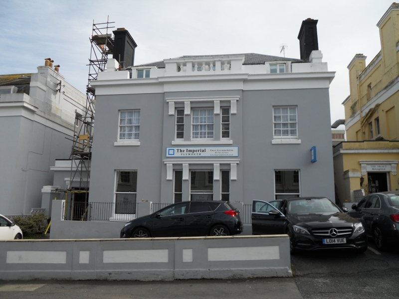
PLYMOUTH
SX4754 LOCKYER STREET, Hoe
740-1/57/283 (East side)
25/01/54 Windsor Villas No.3
(Formerly Listed as:
LOCKYER STREET, Plymouth
Windsor Villas Nos 1-6 (consec))
GV II
Villa in planned group of villas, now used as an hotel.
c1820s-30s. Incised stucco; dry slate mansard roof behind
parapet with moulded entablature and balustraded centre break;
panelled end stacks with moulded cornices; attic windows with
incised pilasters and heads. Double-depth plan with probably 3
rooms at the front and entrance porch to axial entrance hall
from the left.
EXTERIOR: 2 storeys plus attic; symmetrical 3-bay front with
centre bay broken forward plus single-storey porch set back on
the left. Late C19 or C20 horned sashes, original hornless
sashes, with glazing bars to 1st floor; central bay with
tripartite sashes with consoles and moulded hoods;
ground-floor sashes taller. Porch has parapet with moulded
cornice and front doorway with consoles and moulded hood;
4-panel door.
INTERIOR: not inspected but likely to be of interest.
Included as part of an important planned group of terraces and
villas by Foulston and his pupil Wightwick on the Hoe, a
scheme which placed Plymouth in the forefront of town planning
in the early/mid C19.
(The Buildings of England: Pevsner N: Devon: London: 1989-:
664).
Listing NGR: SX4766454166
External links are from the relevant listing authority and, where applicable, Wikidata. Wikidata IDs may be related buildings as well as this specific building. If you want to add or update a link, you will need to do so by editing the Wikidata entry.


Other nearby listed buildings
