Approximate Location Map
Large Map »
Latitude: 51.5073 / 51°30'26"N
Longitude: -1.5322 / 1°31'55"W
OS Eastings: 432562
OS Northings: 178806
OS Grid: SU325788
Mapcode National: GBR 6Z0.HFH
Mapcode Global: VHC1D.DCBW
Plus Code: 9C3WGF49+W4
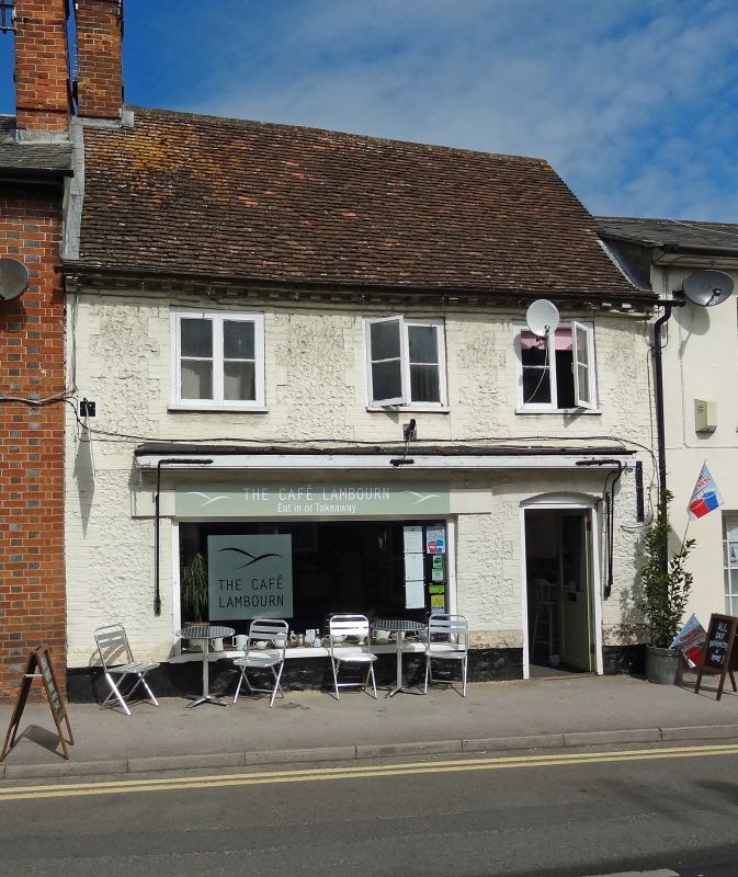
Entry Name: 17, High Street
Listing Date: 11 July 1983
Grade: II
Source: Historic England
Source ID: 1113679
English Heritage Legacy ID: 39412
ID on this website: 101113679
Location: Lambourn, West Berkshire, RG17
County: West Berkshire
Civil Parish: Lambourn
Built-Up Area: Lambourn
Traditional County: Berkshire
Lieutenancy Area (Ceremonial County): Berkshire
Church of England Parish: Lambourn
Church of England Diocese: Oxford
Tagged with: Building
SU 3278 LAMBOURN HIGH STREET
(west side)
4/4 No 17
GV II
House. C17, two storeys, painted sarsen with brick dressings, chimney to left old
tile roof, dentil eaves. 3 casements, modern shop front cambered head to door at
right. Chamfered, stopped beam and old fireplace on ground floor.
Listing NGR: SU3255778809
External links are from the relevant listing authority and, where applicable, Wikidata. Wikidata IDs may be related buildings as well as this specific building. If you want to add or update a link, you will need to do so by editing the Wikidata entry.


Other nearby listed buildings
