Latitude: 51.5223 / 51°31'20"N
Longitude: -1.5487 / 1°32'55"W
OS Eastings: 431404
OS Northings: 180473
OS Grid: SU314804
Mapcode National: GBR 5XG.K8B
Mapcode Global: VHC16.3ZLW
Plus Code: 9C3WGFC2+WG
Entry Name: Granary to South West of Church Farmhouse
Listing Date: 11 July 1983
Grade: II
Source: Historic England
Source ID: 1113688
English Heritage Legacy ID: 39433
ID on this website: 101113688
Location: Upper Lambourn, West Berkshire, RG17
County: West Berkshire
Civil Parish: Lambourn
Built-Up Area: Upper Lambourn
Traditional County: Berkshire
Lieutenancy Area (Ceremonial County): Berkshire
Church of England Parish: Lambourn
Church of England Diocese: Oxford
Tagged with: Granary
SU 38SW LAMBOURN HIGH STREET
UPPER LAMBOURN
(south side)
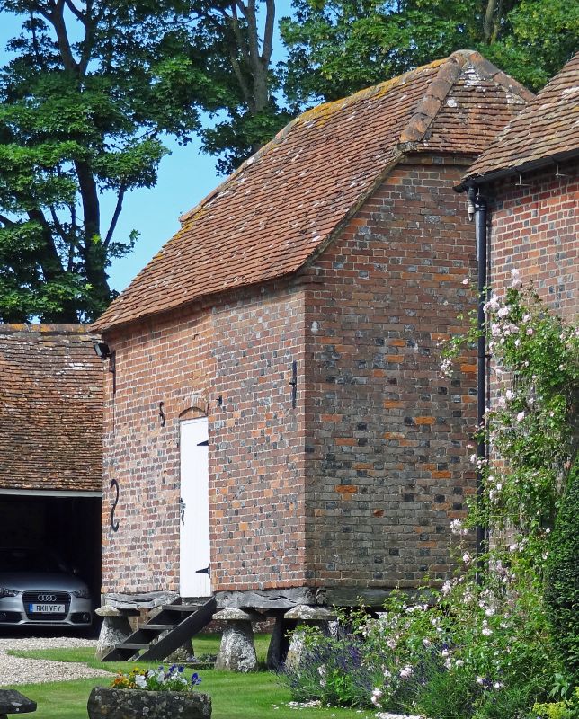
2/5 Granary to south west
of Church Farmhouse
GV II
Granary. C18, old tile ½ hip roof. Brick offset eaves on 4 x 3 staddle stones.
Central ledged and battened door.
Listing NGR: SU3140480473
External links are from the relevant listing authority and, where applicable, Wikidata. Wikidata IDs may be related buildings as well as this specific building. If you want to add or update a link, you will need to do so by editing the Wikidata entry.


Other nearby listed buildings