Latitude: 52.1622 / 52°9'44"N
Longitude: -0.302 / 0°18'7"W
OS Eastings: 516245
OS Northings: 252912
OS Grid: TL162529
Mapcode National: GBR H3B.GGC
Mapcode Global: VHGML.QX79
Plus Code: 9C4X5M6X+V6
Entry Name: Brewhouse and Outbuilding at Church Farm
Listing Date: 31 October 1966
Grade: II
Source: Historic England
Source ID: 1114093
English Heritage Legacy ID: 38458
ID on this website: 101114093
Location: Church End, Central Bedfordshire, SG19
County: Central Bedfordshire
Civil Parish: Tempsford
Traditional County: Bedfordshire
Lieutenancy Area (Ceremonial County): Bedfordshire
Church of England Parish: Tempsford with Little Barford
Church of England Diocese: St.Albans
Tagged with: Brewery Listed building in the United Kingdom
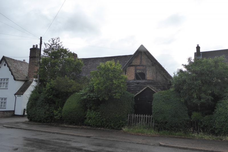
TEMPSFORD CHURCH STREET TL 1652 (Church End) 10/89 Brewhouse and outbuilding 31.10.66 at Church Farm GV II Outbuildings belonging to Church Farm, including former brewhouse. C17 origins with later reworkings. Timber framed, RH wing clad in weatherboarding, LH with colourwashed brick infill and some rebuilding in brick. Clay tile roofs. L-plan, LH wing 2 storeyed, RH wing single storeyed. LH wing has casement windows with glazing bars and integral brick stack to LH gable end. RH gable has gabled timber porch to ground floor with double plank doors. Attic has timber-framing exposed with brick infilling in herringbone pattern and a single light opening with remains of wood latticework. Wavy- edged bargeboards.
Listing NGR: TL1624552912
External links are from the relevant listing authority and, where applicable, Wikidata. Wikidata IDs may be related buildings as well as this specific building. If you want to add or update a link, you will need to do so by editing the Wikidata entry.


Other nearby listed buildings