Approximate Location Map
Large Map »
Latitude: 52.0742 / 52°4'27"N
Longitude: -0.2543 / 0°15'15"W
OS Eastings: 519742
OS Northings: 243194
OS Grid: TL197431
Mapcode National: GBR J5P.VZJ
Mapcode Global: VHGN6.J4Y8
Plus Code: 9C4X3PFW+M7
Entry Name: Holme Grove
Listing Date: 19 December 1975
Grade: II
Source: Historic England
Source ID: 1114492
English Heritage Legacy ID: 37462
ID on this website: 101114492
Location: Central Bedfordshire, SG18
County: Central Bedfordshire
Civil Parish: Biggleswade
Traditional County: Bedfordshire
Lieutenancy Area (Ceremonial County): Bedfordshire
Church of England Parish: Biggleswade
Church of England Diocese: St.Albans
Tagged with: Building
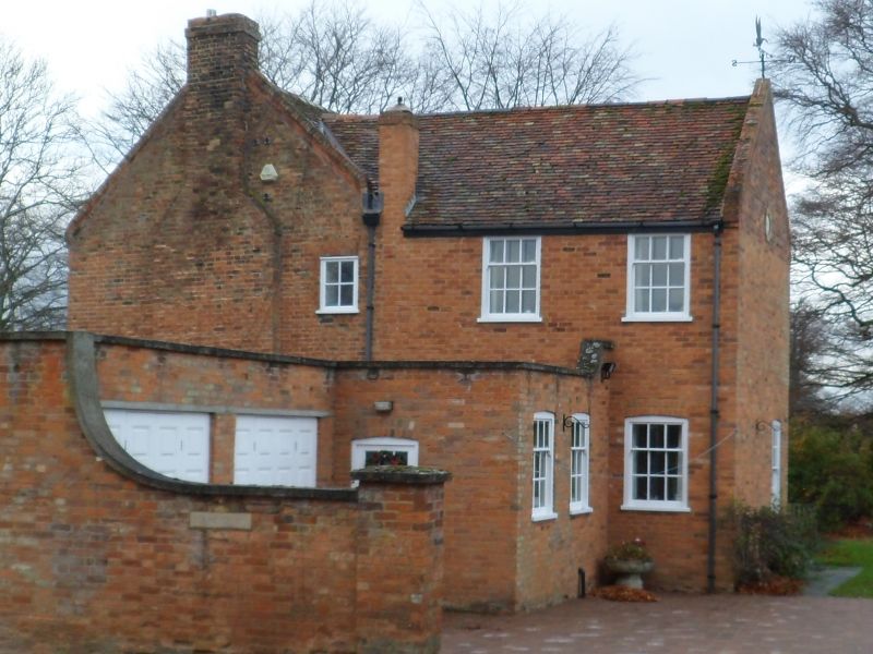
LONDON ROAD
1.
5124
(South-West Side)
Holme Grove
TL 14 SE 4/19 19.12.75
II
2.
C18 with later restoration. Red brick, 2 storey. Old clay tile roof with gable
coping. Five double hung sashes with glazing bars, 6 panel door with rectangular
fanlight, wooden doorcase with flat hood on consoles.
Listing NGR: TL1974243194
External links are from the relevant listing authority and, where applicable, Wikidata. Wikidata IDs may be related buildings as well as this specific building. If you want to add or update a link, you will need to do so by editing the Wikidata entry.


Other nearby listed buildings
