Latitude: 51.9635 / 51°57'48"N
Longitude: -0.4214 / 0°25'17"W
OS Eastings: 508554
OS Northings: 230623
OS Grid: TL085306
Mapcode National: GBR G45.VP4
Mapcode Global: VHFR1.NX25
Plus Code: 9C3XXH7H+9C
Entry Name: Plum Tree Cottage
Listing Date: 3 February 1967
Grade: II
Source: Historic England
Source ID: 1114651
English Heritage Legacy ID: 35882
ID on this website: 101114651
Location: Church End, Central Bedfordshire, MK45
County: Central Bedfordshire
Civil Parish: Barton-le-Clay
Built-Up Area: Barton-le-Clay
Traditional County: Bedfordshire
Lieutenancy Area (Ceremonial County): Bedfordshire
Church of England Parish: Barton-le-Cley
Church of England Diocese: St.Albans
Tagged with: Cottage
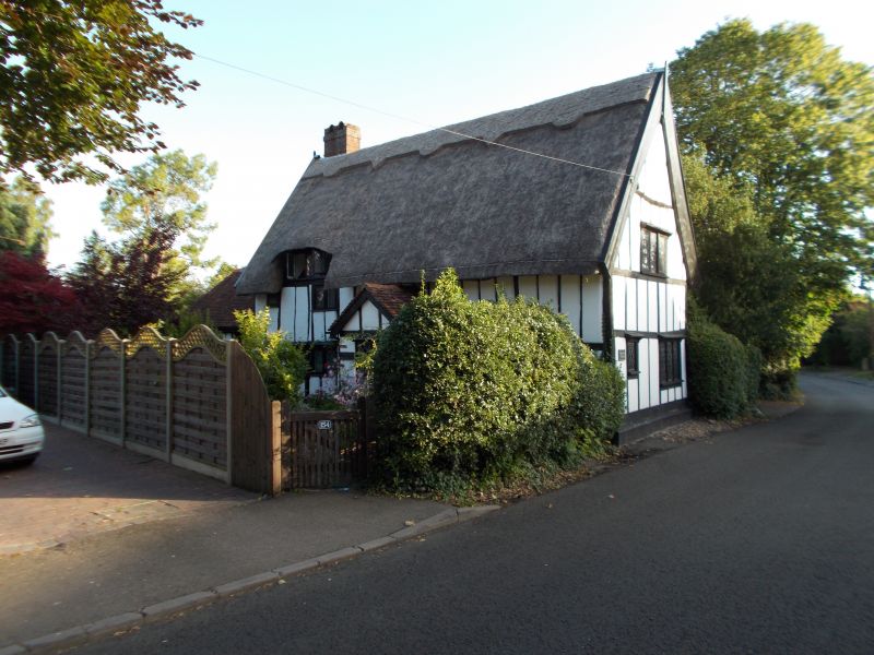
1.
5125 BARTON-LE-CLAY MANOR ROAD
No 154
(Plum Tree Cottage)
TL 03 SE 2/22 3.2.67
II
2.
C17 house, gable end to road. Colour washed plaster infill to timber frame, red
brick in lower gable end. Thatch. Large external stack on north side. Two storeys,
casements with modern diamond leaded lights, eyebrow dormer on south side.
Listing NGR: TL0855430623
External links are from the relevant listing authority and, where applicable, Wikidata. Wikidata IDs may be related buildings as well as this specific building. If you want to add or update a link, you will need to do so by editing the Wikidata entry.


Other nearby listed buildings