Approximate Location Map
Large Map »
Latitude: 51.9258 / 51°55'32"N
Longitude: -0.5787 / 0°34'43"W
OS Eastings: 497828
OS Northings: 226207
OS Grid: SP978262
Mapcode National: GBR F36.BHJ
Mapcode Global: VHFR4.XVDK
Plus Code: 9C3XWCGC+8G
Entry Name: Bull Farmhouse
Listing Date: 26 September 1980
Grade: II
Source: Historic England
Source ID: 1114740
English Heritage Legacy ID: 36097
ID on this website: 101114740
Location: Hockliffe, Central Bedfordshire, LU7
County: Central Bedfordshire
Civil Parish: Hockliffe
Traditional County: Bedfordshire
Lieutenancy Area (Ceremonial County): Bedfordshire
Church of England Parish: Hockliffe
Church of England Diocese: St.Albans
Tagged with: Farmhouse
1.
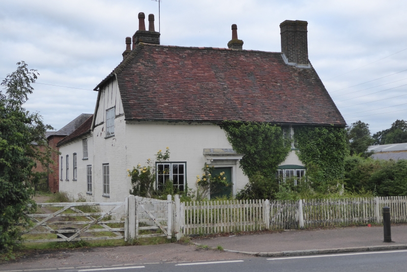
5125 TILSWORTH WATLING STREET
Bull Farmhouse
SP 9726 13/310
II
2.
C18. Colourwashed brick. Two storeys. Half-hipped old clay tile roof. Road
elevation has 3-light casement windows with glazing bars, right hand ground floor
one has cambered relieving arch. Cut bracketed doorhood.
Listing NGR: SP9782826207
External links are from the relevant listing authority and, where applicable, Wikidata. Wikidata IDs may be related buildings as well as this specific building. If you want to add or update a link, you will need to do so by editing the Wikidata entry.


Other nearby listed buildings
