Latitude: 51.5584 / 51°33'30"N
Longitude: -2.3551 / 2°21'18"W
OS Eastings: 375480
OS Northings: 184453
OS Grid: ST754844
Mapcode National: GBR 0NC.CDB
Mapcode Global: VH95V.43B4
Plus Code: 9C3VHJ5V+9X
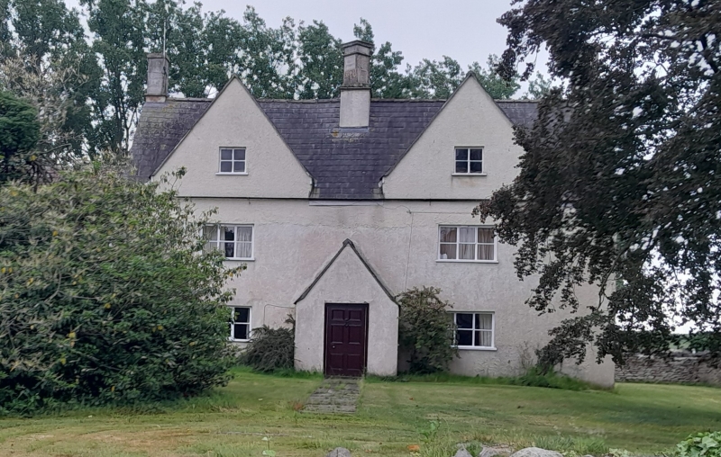
Entry Name: Tungrove Farmhouse
Listing Date: 5 June 1984
Grade: II
Source: Historic England
Source ID: 1115000
English Heritage Legacy ID: 34708
ID on this website: 101115000
Location: Horton, South Gloucestershire, BS37
County: South Gloucestershire
Civil Parish: Horton
Built-Up Area: Horton
Traditional County: Gloucestershire
Lieutenancy Area (Ceremonial County): Gloucestershire
Church of England Parish: Horton St James the Elder
Church of England Diocese: Gloucester
Tagged with: Farmhouse
ST 78 SE
8/85
HORTON
HORTON ROAD
Tungrove Farmhouse
II
Farmhouse. Early - mid C17, altered C20. Rendered; slate roof; central
stack has paired diagonal ashlar chimneys, rendered end stacks. 2 storeys and
attics in 2 steep gables. Two C20 2- and 3-light casement windows. C20
central gabled projecting porch. Projecting 3 storey polygonal stair turret to
rear. (East wing not included). A typical although somewhat altered example
of the gabled vernacular farmhouse.
Listing NGR: ST7548084453
External links are from the relevant listing authority and, where applicable, Wikidata. Wikidata IDs may be related buildings as well as this specific building. If you want to add or update a link, you will need to do so by editing the Wikidata entry.


Other nearby listed buildings