Approximate Location Map
Large Map »
Latitude: 51.5813 / 51°34'52"N
Longitude: -2.4482 / 2°26'53"W
OS Eastings: 369037
OS Northings: 187036
OS Grid: ST690870
Mapcode National: GBR JX.CQVD
Mapcode Global: VH884.JJ23
Plus Code: 9C3VHHJ2+GP
Entry Name: Milestone at National Grid Reference St 6904 8704
Listing Date: 5 June 1984
Grade: II
Source: Historic England
Source ID: 1115027
English Heritage Legacy ID: 34768
ID on this website: 101115027
Location: Bagstone, South Gloucestershire, GL12
County: South Gloucestershire
Civil Parish: Rangeworthy
Traditional County: Gloucestershire
Lieutenancy Area (Ceremonial County): Gloucestershire
Church of England Parish: Rangeworthy Holy Trinity
Church of England Diocese: Gloucester
Tagged with: Milestone
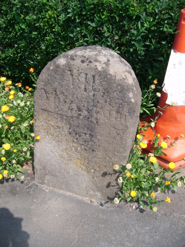
ST 68 NE WICKWAR BAGSTONE (east side)
3/145 Milestone at NGR ST 6904 8704
II
Milestone. Late C18/early C19. Stone upright with semi-circular head.
Incised lettering reads: "VII/Miles from/WOTTON" (name somewhat defaced).
Listing NGR: ST6903787035
External links are from the relevant listing authority and, where applicable, Wikidata. Wikidata IDs may be related buildings as well as this specific building. If you want to add or update a link, you will need to do so by editing the Wikidata entry.


Other nearby listed buildings
