Latitude: 51.3968 / 51°23'48"N
Longitude: -2.3209 / 2°19'15"W
OS Eastings: 377771
OS Northings: 166462
OS Grid: ST777664
Mapcode National: GBR 0QC.823
Mapcode Global: VH96M.Q5D2
Plus Code: 9C3V9MWH+PJ
Entry Name: Kennet and Avon Canal Canal Bridge, 100 Yards to East of George Inn
Listing Date: 19 October 1983
Grade: II
Source: Historic England
Source ID: 1115195
English Heritage Legacy ID: 32020
ID on this website: 101115195
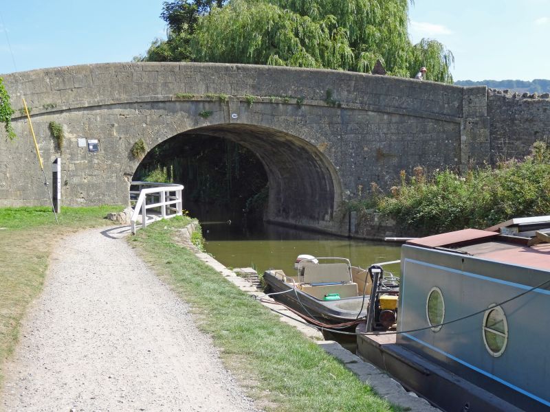
ST 7766 BATHAMPTON C.P. MILL LANE
8/19 Canal Bridge 100 yards to
east of George Inn
G.V.
II
Canal Bridge. Circa 1805-10 for Kennet and Avon Canal. John Rennie, Engineer.
Ashlar. Single span horseshoe arch with triple keystone. Plat band and
parapet.
Listing NGR: ST7777166462
External links are from the relevant listing authority and, where applicable, Wikidata. Wikidata IDs may be related buildings as well as this specific building. If you want to add or update a link, you will need to do so by editing the Wikidata entry.


Other nearby listed buildings