Latitude: 51.1136 / 51°6'48"N
Longitude: 0.4611 / 0°27'39"E
OS Eastings: 572360
OS Northings: 137800
OS Grid: TQ723378
Mapcode National: GBR PT2.3DQ
Mapcode Global: VHJN4.Y83P
Plus Code: 9F324F76+CC
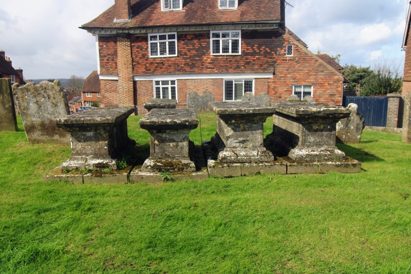
Entry Name: Group of 5 Chest Tombs About 10 to 25 Metres South West of Church of St Mary
Listing Date: 22 June 1989
Grade: II
Source: Historic England
Source ID: 1115572
English Heritage Legacy ID: 169469
ID on this website: 101115572
Location: St Mary's Church, Goudhurst, Tunbridge Wells, Kent, TN17
County: Kent
District: Tunbridge Wells
Civil Parish: Goudhurst
Built-Up Area: Goudhurst
Traditional County: Kent
Lieutenancy Area (Ceremonial County): Kent
Tagged with: Chest tomb
GOUDHURST CHURCH ROAD TQ7237-7337 (south side) 15/119 Group of 5 Chest Tombs about 10 to 25 metres south west of Church of St Mary GV II Group of 5 chest tombs. All late C17/early C18. Stone. A row of 3 almost ident- ical chest tombs with panelled sides and wave-moulded corner pieces, probably crude attemps at urn-shaped corner pieces, and moulded top slabs. A fourth ident- ical chest with adjacent less ornate, monolithic and earlier chest, still with moulded top slab, closer to the church. All inscriptions worn and chests too sunk into ground to be legible.
Listing NGR: TQ7236037800
External links are from the relevant listing authority and, where applicable, Wikidata. Wikidata IDs may be related buildings as well as this specific building. If you want to add or update a link, you will need to do so by editing the Wikidata entry.


Other nearby listed buildings