Approximate Location Map
Large Map »
Latitude: 51.1144 / 51°6'51"N
Longitude: 0.4628 / 0°27'46"E
OS Eastings: 572481
OS Northings: 137896
OS Grid: TQ724378
Mapcode National: GBR PT2.3TL
Mapcode Global: VHJN4.Z811
Plus Code: 9F324F77+Q4
Entry Name: Outhouse About 20 Metres North East of Mill House
Listing Date: 22 June 1989
Grade: II
Source: Historic England
Source ID: 1115650
English Heritage Legacy ID: 169464
ID on this website: 101115650
Location: Goudhurst, Tunbridge Wells, Kent, TN17
County: Kent
District: Tunbridge Wells
Town: Tunbridge Wells
Civil Parish: Goudhurst
Built-Up Area: Goudhurst
Traditional County: Kent
Lieutenancy Area (Ceremonial County): Kent
Tagged with: Outhouse
GOUDHURST CHURCH ROAD
TQ 7237-7337 (north side)
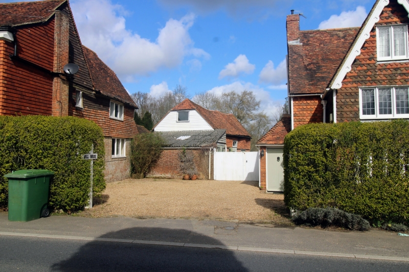
15/114 (Outhouse about 20
metres north east of
Mill House
GV II
Outhouse. Early C19. Timber framed and tile hung on red brick ground floor, with
plain tiled roof and weather-boarded gable. One storey, with half hip to left and
gable to right. Lunette window to left, boarded door to centre left with rectan-
gular fanlight and casement. Lean-to outshot to left. Built as outhouse to the
now demolished mill built c.1819 (see Mill House, item 15/113). Included for
group value.
Listing NGR: TQ7248137896
External links are from the relevant listing authority and, where applicable, Wikidata. Wikidata IDs may be related buildings as well as this specific building. If you want to add or update a link, you will need to do so by editing the Wikidata entry.


Other nearby listed buildings
