Latitude: 51.2498 / 51°14'59"N
Longitude: 0.4541 / 0°27'14"E
OS Eastings: 571364
OS Northings: 152931
OS Grid: TQ713529
Mapcode National: GBR PRB.FMQ
Mapcode Global: VHJMC.TVD8
Plus Code: 9F326FX3+WJ
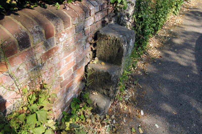
Entry Name: Mounting Block About 16 Metres South South West of the Old Parsonage
Listing Date: 23 May 1967
Grade: II
Source: Historic England
Source ID: 1115774
English Heritage Legacy ID: 174827
ID on this website: 101115774
Location: West Farleigh, Maidstone, Kent, ME15
County: Kent
District: Maidstone
Civil Parish: West Farleigh
Traditional County: Kent
Lieutenancy Area (Ceremonial County): Kent
Church of England Parish: West Farleigh All Saints
Church of England Diocese: Rochester
Tagged with: Building
WEST FARLEIGH LOWER ROAD TQ 75 SW (East side) 2/24 Mounting block 23.5.67 about 16 metres south-south-west of the Old Parsonage GV II
Mounting block. 1693. Single block of ragstone, about 0.30m high carved with three steep, narrow steps rising from north to south, parallel to road. Date 1693 inscribed towards top of road face.
Listing NGR: TQ7136452931
External links are from the relevant listing authority and, where applicable, Wikidata. Wikidata IDs may be related buildings as well as this specific building. If you want to add or update a link, you will need to do so by editing the Wikidata entry.


Other nearby listed buildings