Latitude: 52.113 / 52°6'46"N
Longitude: -0.8262 / 0°49'34"W
OS Eastings: 480479
OS Northings: 246721
OS Grid: SP804467
Mapcode National: GBR CZ7.FY4
Mapcode Global: VHDSS.M5L1
Plus Code: 9C4X457F+5G
Entry Name: 4, the Green
Listing Date: 27 February 1984
Grade: II
Source: Historic England
Source ID: 1115922
English Heritage Legacy ID: 350983
ID on this website: 101115922
Location: Hanslope, Milton Keynes, Buckinghamshire, MK19
County: Milton Keynes
Civil Parish: Hanslope
Built-Up Area: Hanslope
Traditional County: Buckinghamshire
Lieutenancy Area (Ceremonial County): Buckinghamshire
Church of England Parish: Hanslope
Church of England Diocese: Oxford
Tagged with: Building
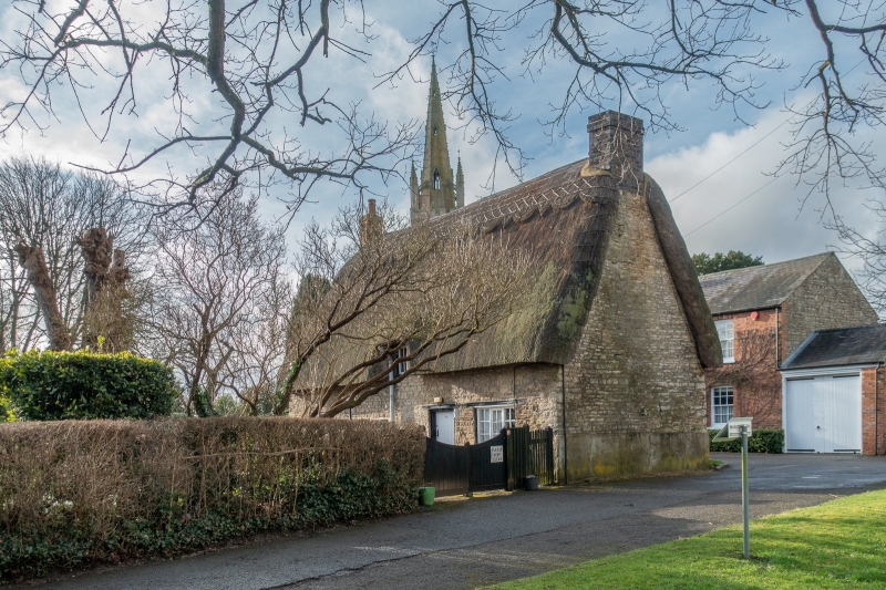
SP 84 NW HANSLOPE THE GREEN
4/78 No 4
-
- II
Cottage. C17-C18. Rubblestone, thatch. One storey plus dormers. Off
centre door. Irregular casements. One dormer centre of south east
front and one to left of north west elevations. Brick end stacks.
Listing NGR: SP8047946721
External links are from the relevant listing authority and, where applicable, Wikidata. Wikidata IDs may be related buildings as well as this specific building. If you want to add or update a link, you will need to do so by editing the Wikidata entry.


Other nearby listed buildings