Latitude: 51.8627 / 51°51'45"N
Longitude: -0.7375 / 0°44'14"W
OS Eastings: 487034
OS Northings: 218992
OS Grid: SP870189
Mapcode National: GBR D2G.0CY
Mapcode Global: VHDV0.5FGW
Plus Code: 9C3XV777+32
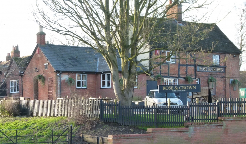
Entry Name: The Rose and Crown
Listing Date: 6 July 1984
Grade: II
Source: Historic England
Source ID: 1115958
English Heritage Legacy ID: 350866
ID on this website: 101115958
Location: Wingrave, Buckinghamshire, HP22
County: Buckinghamshire
Civil Parish: Wingrave with Rowsham
Built-Up Area: Wingrave
Traditional County: Buckinghamshire
Lieutenancy Area (Ceremonial County): Buckinghamshire
Church of England Parish: Wingrave
Church of England Diocese: Oxford
SP 8619 SP 81 NE WINGRAVE WITH ROWSHAM DARK LANE
10/119 8/119 The Rose and Crown
II
Public house. C17, altered late C18 and late C19. Left bay has timber frame with brick infill to first floor, and ground floor rebuilt in brick late C19. Right bay is of late C18 chequer brick with first floor band course and plinth, extended to right in red brick late C19. C20 tile roofs, brick chimneys to left and centre. 2 storeys and attic, 2 bays. Left bay has 3-light barred wcoden casement to ground floor and C19 2-light wooden casement above. Small single light to ground floor between bays. Right bay has blocked ground floor window and barred horizontal sliding sash to first floor. Single storey C20 extension to left is of brick with slate roof, double metal doors and 2 wooden casements.
Listing NGR: SP8703418992
External links are from the relevant listing authority and, where applicable, Wikidata. Wikidata IDs may be related buildings as well as this specific building. If you want to add or update a link, you will need to do so by editing the Wikidata entry.


Other nearby listed buildings