Latitude: 52.0089 / 52°0'31"N
Longitude: -1.5407 / 1°32'26"W
OS Eastings: 431619
OS Northings: 234591
OS Grid: SP316345
Mapcode National: GBR 6S0.18W
Mapcode Global: VHBYW.7RTW
Plus Code: 9C4W2F55+GP
Entry Name: Leasowes Farmhouse
Listing Date: 13 October 1966
Last Amended: 9 April 1987
Grade: II
Source: Historic England
Source ID: 1116078
English Heritage Legacy ID: 306080
ID on this website: 101116078
Location: Whichford, Stratford-on-Avon, Warwickshire, CV36
County: Warwickshire
District: Stratford-on-Avon
Civil Parish: Whichford
Traditional County: Warwickshire
Lieutenancy Area (Ceremonial County): Warwickshire
Church of England Parish: Whichford St Michael
Church of England Diocese: Coventry
Tagged with: Farmhouse
WHICHFORD SP3134 9/146 Leasowes Farmhouse 13/10/66 (Formerly listed as The Leasowes)
GV II
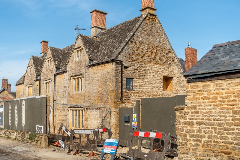
Farmhouse. Mid C17, of 2 stages of building. Squared coursed limestone with quoins and coped gables. Stone-slate roof with rendered brick stacks with original stone bases. 3-unit plan. 2 storeys plus attic; 3-window range. Part-renewed 4-light mullioned windows to ground floor openings, and 3-light mullioned windows to first floor openings. Three C17 full gabled dormers with 2-light mullioned windows. All mullioned windows have hood moulds and labels. To rear a staircase range of 2 storeys plus attic. Further 3-light mullioned windows with hood mould and labels. C19 two-storey stone range to rear left, with C20 stone extension in angle. Interior; some chamfered spine beams, Ovolo-moulded spine beams to ground and first floors. 2 large open fireplaces with ovolo-moulded timber bressumers. Newel staircase rising to attics. Some stone flagged floors. (V.C.H.: Warwickshire, Vol.5, p.205).
Listing NGR: SP3161934591
External links are from the relevant listing authority and, where applicable, Wikidata. Wikidata IDs may be related buildings as well as this specific building. If you want to add or update a link, you will need to do so by editing the Wikidata entry.


Other nearby listed buildings