Latitude: 51.5086 / 51°30'31"N
Longitude: -2.5087 / 2°30'31"W
OS Eastings: 364788
OS Northings: 178977
OS Grid: ST647789
Mapcode National: GBR JV.J1NS
Mapcode Global: VH88H.GBLV
Plus Code: 9C3VGF5R+CG
Entry Name: Moorend House
Listing Date: 15 July 1981
Grade: II
Source: Historic England
Source ID: 1116178
English Heritage Legacy ID: 28765
ID on this website: 101116178
Location: Whiteshill, South Gloucestershire, BS16
County: South Gloucestershire
Civil Parish: Winterbourne
Built-Up Area: Hambrook
Traditional County: Gloucestershire
Lieutenancy Area (Ceremonial County): Gloucestershire
Church of England Parish: Winterbourne Down
Church of England Diocese: Bristol
Tagged with: House
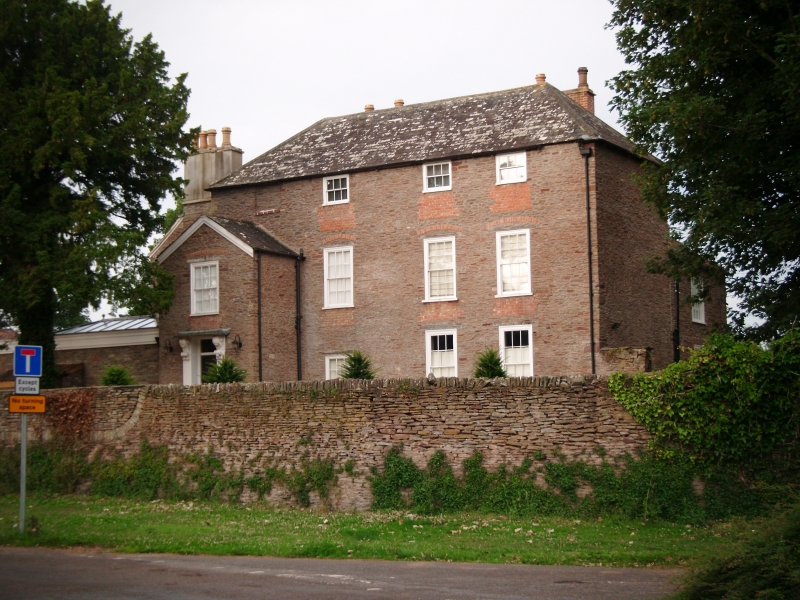
1. 5118 EX-MANGOTSFIELD UD BROMLEY HEATH ROAD Moorend Moorend House ST 67 NW 1/190 II 2. C18. Coursed rubble. Hipped random coursed hipped slate roof. Two storeys, attic and basement (attics close under eaves). Three windows and one (latter blind). Glazing bar sashes in exposed frames, brick relieving arches to first floor windows. Brick filler below attic and first floor windows. Gabled 2 storey porch to left with sash window over door. Square headed door opening with thin slab hood (later) on heavy acanthus leaf brackets. Two storey extension at right angles, 2 windows and pantile roof - despite its mid-C19 appearance, this wing appears on the deeds of 1801 when the house was sold as a school.
Listing NGR: ST6478878977
External links are from the relevant listing authority and, where applicable, Wikidata. Wikidata IDs may be related buildings as well as this specific building. If you want to add or update a link, you will need to do so by editing the Wikidata entry.


Other nearby listed buildings