Approximate Location Map
Large Map »
Latitude: 51.0538 / 51°3'13"N
Longitude: 0.6214 / 0°37'16"E
OS Eastings: 583815
OS Northings: 131537
OS Grid: TQ838315
Mapcode National: GBR QW6.V87
Mapcode Global: FRA D65B.KWZ
Plus Code: 9F323J3C+GG
Entry Name: Rolvenden Windmill
Listing Date: 16 August 1962
Grade: II*
Source: Historic England
Source ID: 1116206
English Heritage Legacy ID: 180312
ID on this website: 101116206
ROLVENDEN BENENDEN ROAD
1.
5272
(south side)
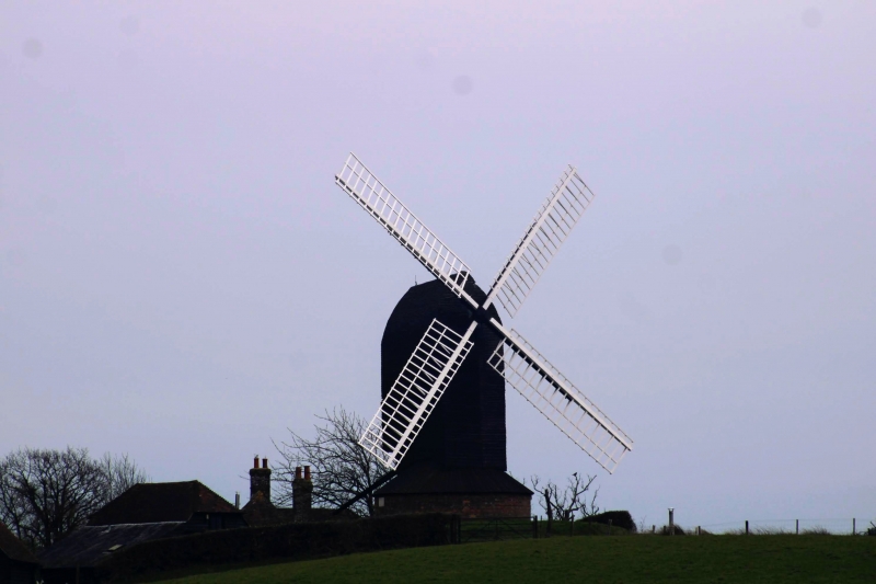
Rolvenden Windmill
TQ 83 SW 7/268 16.8.62.
II*
2.
Probable late Cl7 or early C18 mill on the site of an earlier mill of 1596.
It ceased work in 1883. Post type. Faced with tarred weatherboarding. Modern
octagonal 'roundhouse' also faced with tarred weatherboarding but part of
it now missing. Four restored sweeps. Tailpole extant.
Listing NGR: TQ8403631502
External links are from the relevant listing authority and, where applicable, Wikidata. Wikidata IDs may be related buildings as well as this specific building. If you want to add or update a link, you will need to do so by editing the Wikidata entry.


Other nearby listed buildings
