Approximate Location Map
Large Map »
Latitude: 51.7522 / 51°45'8"N
Longitude: -1.2567 / 1°15'24"W
OS Eastings: 451405
OS Northings: 206210
OS Grid: SP514062
Mapcode National: GBR 8Z4.13V
Mapcode Global: VHCXV.57H2
Plus Code: 9C3WQP2V+V8
Entry Name: 11, High Street
Listing Date: 12 January 1954
Grade: II
Source: Historic England
Source ID: 1116316
English Heritage Legacy ID: 245472
ID on this website: 101116316
Location: Oxford, Oxfordshire, OX1
County: Oxfordshire
District: Oxford
Electoral Ward/Division: Carfax
Parish: Non Civil Parish
Built-Up Area: Oxford
Traditional County: Oxfordshire
Lieutenancy Area (Ceremonial County): Oxfordshire
Church of England Parish: Oxford St Michael and St Martin and All Saints
Church of England Diocese: Oxford
Tagged with: Building
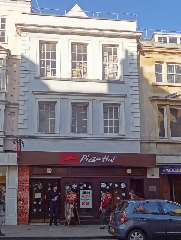
1. HIGH STREET
1485
(North Side)
No 11
SP 5106 5W 8/310 12.1.54.
II GV
2.
3-storeyed front with rusticated painted quoins. An ancient gable is visible
behind. Parapet, roof not visible. Stucco. 3 windows with architrave surrounds
on each floor.
All the listed buildings on the North Side form a group.
Listing NGR: SP5141606212
External links are from the relevant listing authority and, where applicable, Wikidata. Wikidata IDs may be related buildings as well as this specific building. If you want to add or update a link, you will need to do so by editing the Wikidata entry.


Other nearby listed buildings
