Latitude: 51.0546 / 51°3'16"N
Longitude: 0.8164 / 0°48'59"E
OS Eastings: 597478
OS Northings: 132132
OS Grid: TQ974321
Mapcode National: GBR RXS.WRF
Mapcode Global: FRA D6LB.HVJ
Plus Code: 9F323R38+RH
Entry Name: Church of St Mary
Listing Date: 16 August 1962
Grade: II*
Source: Historic England
Source ID: 1116484
English Heritage Legacy ID: 180274
Also known as: St Mary's Church, Kenardington
ID on this website: 101116484
Location: St Mary's Church, Kenardington, Ashford, Kent, TN26
County: Kent
District: Ashford
Civil Parish: Kenardington
Traditional County: Kent
Lieutenancy Area (Ceremonial County): Kent
Tagged with: Church building
KENARDINGTON 1. 5272 Church of St Mary TQ 93 SE 10/223 16.8.62. II*
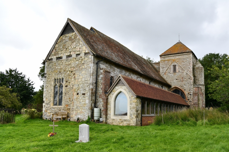
2. Parish Church. Chancel, nave, south porch and west tower with a circular vice turret to the north of it. This is all that remains of a larger church with north and south aisles and chapels which was struck by lightning in 1559. The chancel is about two-thirds the width of the nave and not central. The tower is C13 and stands at the north-west corner of the nave with no communication between the two but a blocked arch on the east side of the tower which led into the demolished north aisle. The chancel and nave are Cl5 and have blocked arches on the south side which led into the demolished south aisle and south chapel. The churchyard contains some C18 headstones with cherub and skull motifs and some early C19 sunray motif headstones.
Listing NGR: TQ9747832132
External links are from the relevant listing authority and, where applicable, Wikidata. Wikidata IDs may be related buildings as well as this specific building. If you want to add or update a link, you will need to do so by editing the Wikidata entry.


Other nearby listed buildings