Approximate Location Map
Large Map »
Latitude: 51.2361 / 51°14'9"N
Longitude: 0.7187 / 0°43'7"E
OS Eastings: 589884
OS Northings: 152057
OS Grid: TQ898520
Mapcode National: GBR QT6.GHN
Mapcode Global: VHKK5.D6S7
Plus Code: 9F326PP9+CF
Entry Name: The Tithe Barn
Listing Date: 20 October 1952
Grade: I
Source: Historic England
Source ID: 1116543
English Heritage Legacy ID: 173906
ID on this website: 101116543
Location: Lenham, Maidstone, Kent, ME17
County: Kent
District: Maidstone
Civil Parish: Lenham
Built-Up Area: Lenham
Traditional County: Kent
Lieutenancy Area (Ceremonial County): Kent
Tagged with: Tithe barn Architectural structure
This list entry was subject to a Minor Amendment on 16/09/2019
TQ 8952
10/171
LENHAM
HIGH STREET (east side)
Court Lodge Farm
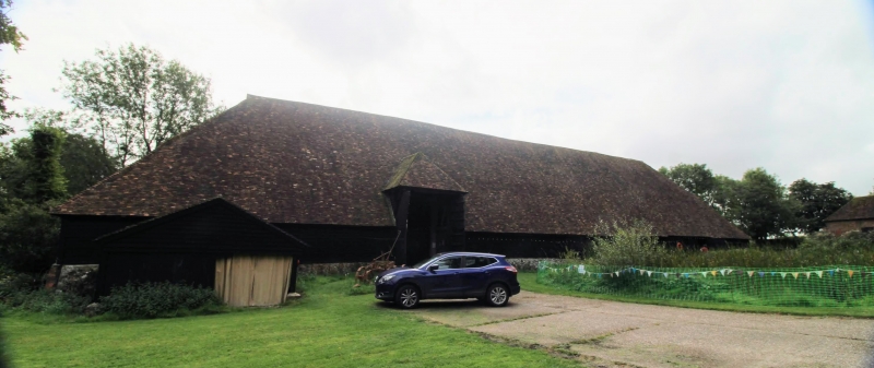
The Tithe Barn
(Formerly listed as Barn circa 40 yards north west of Court Lodge, HIGH STREET)
20.10.52.
GV
I
Barn. Probably late C14. Timber framed, weatherboarded, on patched stone plinth with hipped plain tile roof, C19 canopy towards left end of west elevation, and plain double doors towards right end.
Interior: nine bays (seven original, two late C15 or early C16), with aisles to ends and both sides. Posts on wood cills, some with stone pedestal under, some with continuous stone plinths. Normal assembly to outer walls. Slightly curved passing shores from cill to top of posts. Curved braces (some replaced) from arcade posts to arcade plates and tie-beams. Single, probably later, purlin to aisle roofs, pegged intermittently to rafters, with raked Queen posts from aisle tiles. Jowled arcade posts. Plain crown posts with two curved downward braces and two upward braces. Lapped collars. Some replacement of wall studs, but usually in same mortices. Evidence for arch bracing to outer walls.
On a demesne of St. Augustines, Canterbury. One of two; 'the other, at right angles to north west, burnt 1962. (S.E. Rigold, Archaeologia Cantiana Vol. LXXXI, 1966).
Listing NGR: TQ8988452057
External links are from the relevant listing authority and, where applicable, Wikidata. Wikidata IDs may be related buildings as well as this specific building. If you want to add or update a link, you will need to do so by editing the Wikidata entry.


Other nearby listed buildings
