Approximate Location Map
Large Map »
Latitude: 52.071 / 52°4'15"N
Longitude: -2.0259 / 2°1'33"W
OS Eastings: 398318
OS Northings: 241408
OS Grid: SO983414
Mapcode National: GBR 2K8.4MB
Mapcode Global: VHB0Y.T6TP
Plus Code: 9C4V3XCF+CJ
Entry Name: Village Cross
Listing Date: 11 February 1965
Grade: II
Source: Historic England
Source ID: 1116596
English Heritage Legacy ID: 442998
ID on this website: 101116596
Location: Elmley Castle, Wychavon, Worcestershire, WR10
County: Worcestershire
District: Wychavon
Civil Parish: Elmley Castle
Built-Up Area: Elmley Castle
Traditional County: Worcestershire
Lieutenancy Area (Ceremonial County): Worcestershire
Church of England Parish: Elmley Castle with Netherton, Bricklehampton, Gt Combrton and Lt Comberton
Church of England Diocese: Worcester
ELMLEY CASTLE ELMLEY CASTLE
1.
2301
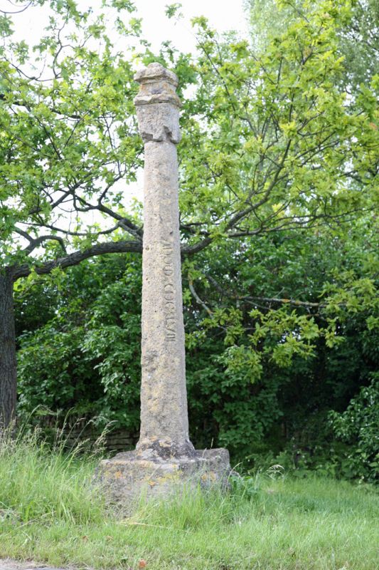
Village Cross
SO 9841 24/376 11.2.65.
II
2.
C14. Graduated base with tapering stone shaft, and later capital with moulded
cornices. AM.
Listing NGR: SO9831841408
External links are from the relevant listing authority and, where applicable, Wikidata. Wikidata IDs may be related buildings as well as this specific building. If you want to add or update a link, you will need to do so by editing the Wikidata entry.


Other nearby listed buildings
