Approximate Location Map
Large Map »
Latitude: 50.7996 / 50°47'58"N
Longitude: -3.1887 / 3°11'19"W
OS Eastings: 316323
OS Northings: 100673
OS Grid: ST163006
Mapcode National: GBR LX.YXNB
Mapcode Global: FRA 466Z.HJQ
Plus Code: 9C2RQRX6+RG
Entry Name: 78, High Street
Listing Date: 21 March 1972
Grade: II
Source: Historic England
Source ID: 1116658
English Heritage Legacy ID: 442964
ID on this website: 101116658
Location: Honiton, East Devon, EX14
County: Devon
District: East Devon
Civil Parish: Honiton
Built-Up Area: Honiton
Traditional County: Devon
Lieutenancy Area (Ceremonial County): Devon
Church of England Parish: Honiton with Monkton
Church of England Diocese: Exeter
Tagged with: Building
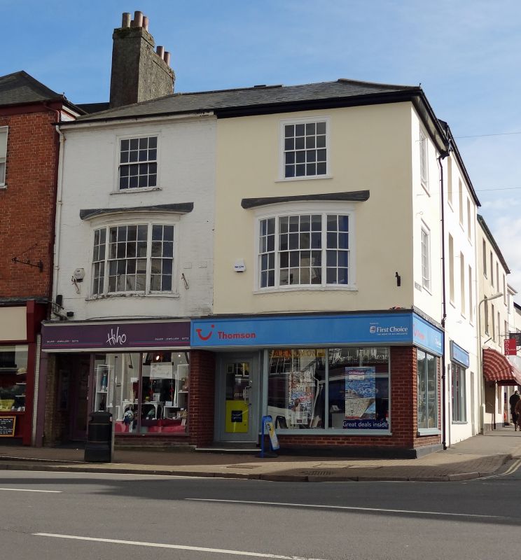
1. HIGH STREET
1228 (South Side)
No 78
ST 1600 1/67
II GV
2.
Probably Cl8, 3 storey 2 flush frame sash windows and 2nd floor with glazing
bars, brick limewashed, 2 wide 3-light canted 1st floor bow windows with
glazing bars. Modern shop. Slate roof, hipped. 1 window on return, west.
Nos 68 and 72 to 78 (even) form a group also forms group with continuation of premises in New Street.
Listing NGR: ST1632300673
External links are from the relevant listing authority and, where applicable, Wikidata. Wikidata IDs may be related buildings as well as this specific building. If you want to add or update a link, you will need to do so by editing the Wikidata entry.


Other nearby listed buildings
