Latitude: 50.8008 / 50°48'2"N
Longitude: -3.1858 / 3°11'8"W
OS Eastings: 316529
OS Northings: 100804
OS Grid: ST165008
Mapcode National: GBR LX.YYJ1
Mapcode Global: FRA 466Z.BNK
Plus Code: 9C2RRR27+8M
Entry Name: Lyndhurst
Listing Date: 21 March 1972
Grade: II
Source: Historic England
Source ID: 1116958
English Heritage Legacy ID: 442536
ID on this website: 101116958
Location: Honiton, East Devon, EX14
County: Devon
District: East Devon
Civil Parish: Honiton
Built-Up Area: Honiton
Traditional County: Devon
Lieutenancy Area (Ceremonial County): Devon
Church of England Parish: Honiton with Monkton
Church of England Diocese: Exeter
Tagged with: Building
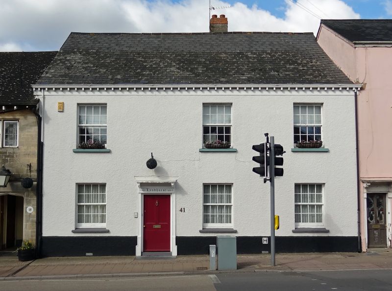
1. HIGH SiFEET
1228 (North Side)
No 41
(Lyndhurst)
ST 1600 1/26
II GV
2.
Probably C18 altered, 2 storey, roughcast, 5 sash windows at lst floor.
Late C18 or early C19 doorcase with flat hood on shaped brackets. Plinth.
Slates.
Nos 35, 39, 41, Nos 49 to 57 (odd) and No 61 fovm a group.
Listing NGR: ST1652900804
External links are from the relevant listing authority and, where applicable, Wikidata. Wikidata IDs may be related buildings as well as this specific building. If you want to add or update a link, you will need to do so by editing the Wikidata entry.


Other nearby listed buildings