Approximate Location Map
Large Map »
Latitude: 52.03 / 52°1'47"N
Longitude: -2.1154 / 2°6'55"W
OS Eastings: 392179
OS Northings: 236845
OS Grid: SO921368
Mapcode National: GBR 2KK.L0N
Mapcode Global: VH93N.971N
Plus Code: 9C4V2VHM+XR
Entry Name: College Farmhouse
Listing Date: 3 August 1972
Grade: II
Source: Historic England
Source ID: 1117065
English Heritage Legacy ID: 442287
ID on this website: 101117065
Location: Bredon, Wychavon, Worcestershire, GL20
County: Worcestershire
District: Wychavon
Civil Parish: Bredon
Built-Up Area: Bredon
Traditional County: Worcestershire
Lieutenancy Area (Ceremonial County): Worcestershire
Church of England Parish: Bredon
Church of England Diocese: Worcester
Tagged with: Farmhouse
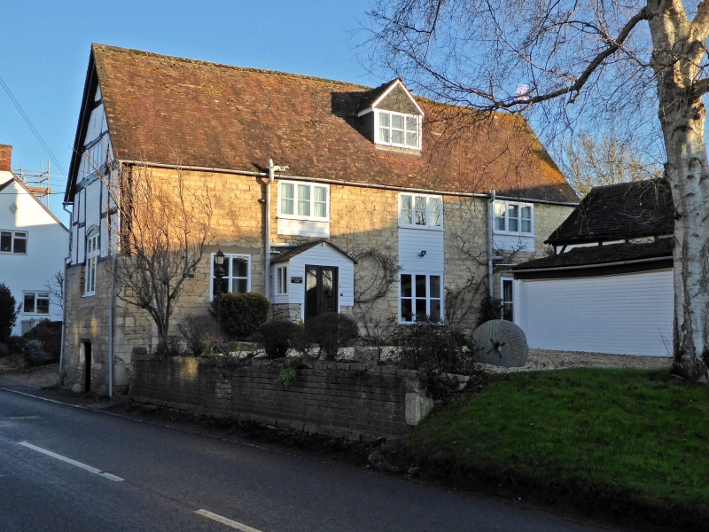
BREDON BREDON
1.
2301
Tewkesbury Road
College Farmhouse
SO 9236 25/113
II
2.
C17 timber framed and whitened brick house with tile roof, high stone plinth.
Gable end onto road. Modern casements. Gabled dormer. Used to be dairy
farm for Balliol College, Oxford.
Listing NGR: SO9217936845
External links are from the relevant listing authority and, where applicable, Wikidata. Wikidata IDs may be related buildings as well as this specific building. If you want to add or update a link, you will need to do so by editing the Wikidata entry.


Other nearby listed buildings
