Approximate Location Map
Large Map »
Latitude: 51.3827 / 51°22'57"N
Longitude: -1.1525 / 1°9'9"W
OS Eastings: 459073
OS Northings: 165196
OS Grid: SU590651
Mapcode National: GBR 93Q.9FG
Mapcode Global: VHCZM.ZH2V
Plus Code: 9C3W9RMW+3X
Entry Name: 34, the Street
Listing Date: 14 April 1967
Grade: II
Source: Historic England
Source ID: 1117328
English Heritage Legacy ID: 39523
ID on this website: 101117328
Location: Aldermaston, West Berkshire, RG7
County: West Berkshire
Civil Parish: Aldermaston
Traditional County: Berkshire
Lieutenancy Area (Ceremonial County): Berkshire
Church of England Parish: Aldermaston
Church of England Diocese: Oxford
Tagged with: Building
SU 5965
10/17
14.4.67
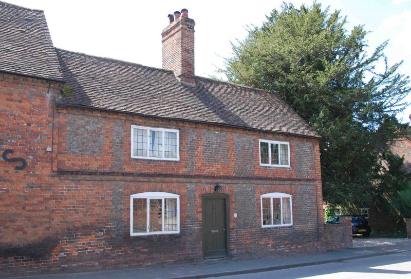
ALDERMASTON
THE STREET (west side)
No. 34
GV
II
House. Circa 1800. Grey headers with red dressings, plinth, plat band;
dentil brick eaves cornice to old tile roof with central ridge stack. Lobby
entrance type. 2 storeys; leaded casements. 2 first floor 3-light casements,
central 4-panelled door with segmental head flanked by two 3-light casements with
segmental heads.
Listing NGR: SU5907365196
External links are from the relevant listing authority and, where applicable, Wikidata. Wikidata IDs may be related buildings as well as this specific building. If you want to add or update a link, you will need to do so by editing the Wikidata entry.


Other nearby listed buildings
