Latitude: 52.0335 / 52°2'0"N
Longitude: -0.2863 / 0°17'10"W
OS Eastings: 517657
OS Northings: 238620
OS Grid: TL176386
Mapcode National: GBR H4X.DGR
Mapcode Global: VHGND.040Y
Plus Code: 9C4X2PM7+CF
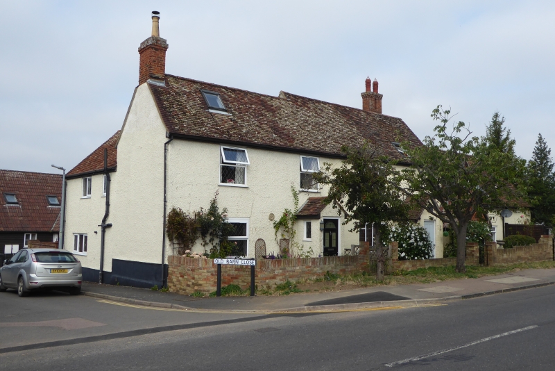
Entry Name: 87, 87B and 87C High Street
Listing Date: 14 December 1995
Grade: II
Source: Historic England
Source ID: 1117387
English Heritage Legacy ID: 442135
ID on this website: 101117387
Location: Henlow, Central Bedfordshire, SG16
County: Central Bedfordshire
Civil Parish: Henlow
Built-Up Area: Henlow
Traditional County: Bedfordshire
Lieutenancy Area (Ceremonial County): Bedfordshire
Church of England Parish: Henlow
Church of England Diocese: St.Albans
Tagged with: Farmhouse
This list entry was subject to a Minor Amendment on 9 October 2024 to update the name and address and reformat the text to current standards.
TL 1738
346-/12/10002
HENLOW
HIGH STREET
Nos.87, 87B and 87C
(Formerly listed as Nos. 87 and 87B (odd) Manor Farmhouse)
II
Former farmhouse, now subdivided. Part early C16 or earlier, extended C17 and C18, refenestrated C19 and C20. Timber framed, with exposed gable with jowled posts and diagonal bracing to rear, but remainder brick mainly painted. Tiled roof with brick chimney stack in centre of range and at end.
No 87 is of one storey and attics at front with gabled dormer and 2 storeys to rear with decorative tiles above brick. Two casement windows and gabled and tilehung painted brick porch. No 87B and 87C is L-shaped of two storeys with three windows to main range. Front has one C20 casement and one mid C19 casement with vertical glazing bars. Rear has projecting timber framed gable.
Interior features include frame with curved braces and curved tie beam, roof with coupled rafters, through purlins and collar beams and mid C 17 axial beam with chamfer, fillet, tongue and triangle.
This building was at one time owned by the Wrest Park Estate and is shown on an estate map of Henlow dated 1718 (Ref MA5/1)
Listing NGR: TL1765738620
External links are from the relevant listing authority and, where applicable, Wikidata. Wikidata IDs may be related buildings as well as this specific building. If you want to add or update a link, you will need to do so by editing the Wikidata entry.


Other nearby listed buildings