Approximate Location Map
Large Map »
Latitude: 51.5239 / 51°31'26"N
Longitude: -0.7021 / 0°42'7"W
OS Eastings: 490141
OS Northings: 181356
OS Grid: SU901813
Mapcode National: GBR D6K.H9Y
Mapcode Global: VHDWK.SY6M
Plus Code: 9C3XG7FX+H5
Entry Name: Maidenhead Bridge
Listing Date: 27 February 1950
Grade: I
Source: Historic England
Source ID: 1117619
English Heritage Legacy ID: 40732
ID on this website: 101117619
Location: Windsor and Maidenhead, Berkshire, SL6
County: Windsor and Maidenhead
Civil Parish: Taplow
Built-Up Area: Maidenhead
Traditional County: Berkshire
Lieutenancy Area (Ceremonial County): Buckinghamshire
Church of England Parish: Maidenhead St Andrew
Church of England Diocese: Oxford
Tagged with: Bridge
SU 98 SW
2/23
BRIDGE ROAD (north side)
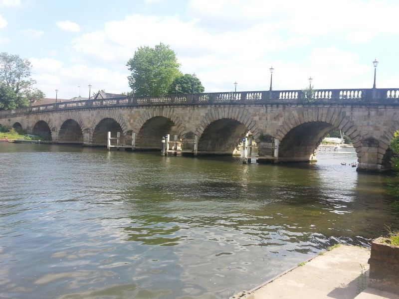
Maidenhead Bridge
27.2.50
I
Opened to traffic in 1777. Built by John Townsend of Oxford to the design of and under supervision of Sir Robert Taylor. Portland stone. Five arches over river with four diminishing arches in the approaches, stone projecting verniculated voussoirs, moulded cornice and balustrade.
Listing NGR: SU9014181356
External links are from the relevant listing authority and, where applicable, Wikidata. Wikidata IDs may be related buildings as well as this specific building. If you want to add or update a link, you will need to do so by editing the Wikidata entry.


Other nearby listed buildings
