Latitude: 51.7675 / 51°46'3"N
Longitude: -0.9268 / 0°55'36"W
OS Eastings: 474157
OS Northings: 208194
OS Grid: SP741081
Mapcode National: GBR C21.0K7
Mapcode Global: VHDV8.WTFW
Plus Code: 9C3XQ39F+27
Entry Name: Number 10 Together with Witchert Wall to North and Railings Fronting Road
Listing Date: 11 October 1985
Grade: II
Source: Historic England
Source ID: 1118251
English Heritage Legacy ID: 43147
ID on this website: 101118251
Location: Church End, Buckinghamshire, HP17
County: Buckinghamshire
Civil Parish: Haddenham
Built-Up Area: Haddenham
Traditional County: Buckinghamshire
Lieutenancy Area (Ceremonial County): Buckinghamshire
Church of England Parish: Haddenham
Church of England Diocese: Oxford
Tagged with: Building
SP 7408 HADDENHAM CHURCHWAY (east side)
11/206 No. 10, together with witchert wall to north and railings fronting road
-
GV II
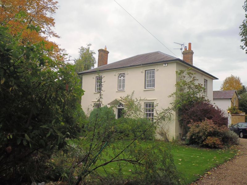
House. Circa 1835. Witchert. Colourwashed and rendered. Hipped slate roof. 2 storeys and 3 bays. Central 4 panel door, radiating fanlight over in architraved doorcase with open pedimented hood on console brackets. 3-pane sashes to outer bays, margined casement with radial and margined fanlight over to centre first floor window, all with moulded labels. Left hand stack and right hand one at rear. Rendered witchert wall with rubble plinth and tiled coping runs north then west along north boundary to link up with wall fronting road. Brick, half- round coping. Centre part has cast-iron railings with foliage spearhead finials. Central cast iron gate similar. House is interesting example of high quality use of witchert on a late Georgian villa.
Listing NGR: SP7415708194
External links are from the relevant listing authority and, where applicable, Wikidata. Wikidata IDs may be related buildings as well as this specific building. If you want to add or update a link, you will need to do so by editing the Wikidata entry.


Other nearby listed buildings