Latitude: 50.9134 / 50°54'48"N
Longitude: -2.108 / 2°6'28"W
OS Eastings: 392500
OS Northings: 112662
OS Grid: ST925126
Mapcode National: GBR 303.MVR
Mapcode Global: FRA 66GP.JK3
Plus Code: 9C2VWV7R+9Q
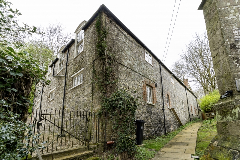
Entry Name: Former stable block 50 metres north of Tarrant Gunville Manor House
Listing Date: 29 December 1976
Grade: II
Source: Historic England
Source ID: 1118530
English Heritage Legacy ID: 103666
ID on this website: 101118530
Location: Tarrant Gunville, Dorset, DT11
County: Dorset
Civil Parish: Tarrant Gunville
Traditional County: Dorset
Lieutenancy Area (Ceremonial County): Dorset
Church of England Parish: Tarrant Gunville St Mary
Church of England Diocese: Salisbury
Tagged with: Stable
This list entry was subject to a Minor Amendment on 13 February 2025 to amend the name and address and reformat the text to current standards.
ST 9212
9/38
TARRANT GUNVILLE
Stable Cottage and Stable Flat
Former stable block 50 metres north of Tarrant Gunville Manor House
(Formerly listed as Stable block 50m north of Tarrant Gunville Manor House, TARRANT GUNVILLE)
29.12.76
GV
II
Stable block, late C18 with C20 alterations. Flint, rubble and brick to the rear with main facade in English-bond brickwork. Hipped slate roofs. Half-H plan. One and a half storeys, nine window range. Casements with glazing bars below. C20 sashed dormers above. Segmental headed coach doors. Roof has cupola with weathervane.
Listing NGR: ST9250012662
External links are from the relevant listing authority and, where applicable, Wikidata. Wikidata IDs may be related buildings as well as this specific building. If you want to add or update a link, you will need to do so by editing the Wikidata entry.


Other nearby listed buildings