Latitude: 50.7151 / 50°42'54"N
Longitude: -2.441 / 2°26'27"W
OS Eastings: 368964
OS Northings: 90702
OS Grid: SY689907
Mapcode National: GBR PY.RDX0
Mapcode Global: FRA 57S6.0VN
Plus Code: 9C2VPH85+2J
Entry Name: 44, High West Street
Listing Date: 8 May 1950
Grade: II
Source: Historic England
Source ID: 1119065
English Heritage Legacy ID: 104370
ID on this website: 101119065
Location: Dorchester, Dorset, DT1
County: Dorset
Civil Parish: Dorchester
Built-Up Area: Dorchester
Traditional County: Dorset
Lieutenancy Area (Ceremonial County): Dorset
Church of England Parish: Dorchester and West Stafford
Church of England Diocese: Salisbury
Tagged with: Building
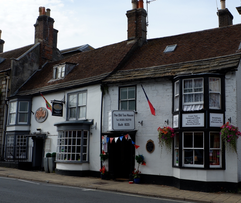
HIGH WEST STREET 1. 5191 (North Side) No 44 SY 6890 7/67 8.5.50. II GV 2. Dated 1635. 2 storeys plasterd front of similar date or earlier. Old plaintile roof with stone slates at eaves. Doorway of C18 date similar to No 43. Tea-shop advertisement boards above hood. Sash window over. On right hand of front is 2 storey splayed bay. No original glazing bars. Nos 41 to 45 (consec)form a group.
Listing NGR: SY6896490702
External links are from the relevant listing authority and, where applicable, Wikidata. Wikidata IDs may be related buildings as well as this specific building. If you want to add or update a link, you will need to do so by editing the Wikidata entry.


Other nearby listed buildings