Latitude: 50.7481 / 50°44'53"N
Longitude: -2.3434 / 2°20'36"W
OS Eastings: 375867
OS Northings: 94331
OS Grid: SY758943
Mapcode National: GBR 0Z8.2C1
Mapcode Global: FRA 57Z3.GVT
Plus Code: 9C2VPMX4+6J
Entry Name: Churchyard Cross, in the Churchyard, 15M South of the South Porch of the Church of Saint Mary
Listing Date: 10 March 1987
Grade: II
Source: Historic England
Source ID: 1119089
English Heritage Legacy ID: 106302
ID on this website: 101119089
Location: St Mary's Church, Puddletown, Dorset, DT2
County: Dorset
Civil Parish: Puddletown
Built-Up Area: Puddletown
Traditional County: Dorset
Lieutenancy Area (Ceremonial County): Dorset
Church of England Parish: Puddletown with Athelhampton and Burleston St Mary the Virgin
Church of England Diocese: Salisbury
Tagged with: Churchyard cross
PUDDLETOWN SY 7594 THE SQUARE (South side) 14/114 Churchyard cross, in the churchyard, 15m south of the south porch of the Church of Saint Mary
GV II
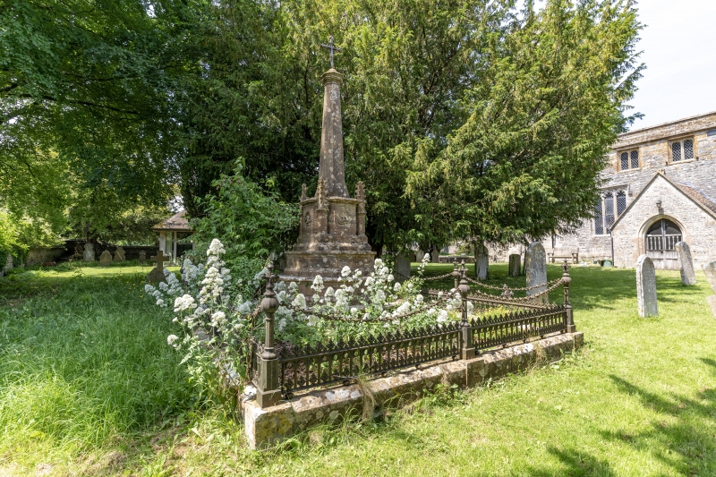
Churchyard cross. Probably C19, but no date visible. Tapered octagonal stone shaft, with moulded cap, surmounted by an iron cross head. This stands on an octagonal base with moulded cap,and pinnacles outside alternate faces. In the intermediate faces carved symbols of the Evangelists. All set on a podium of 3 steps with shaped risers and plinths, and surrounded by ornamental cast iron railings.
Listing NGR: SY7586794339
External links are from the relevant listing authority and, where applicable, Wikidata. Wikidata IDs may be related buildings as well as this specific building. If you want to add or update a link, you will need to do so by editing the Wikidata entry.


Other nearby listed buildings