Latitude: 50.8764 / 50°52'35"N
Longitude: -2.5448 / 2°32'41"W
OS Eastings: 361762
OS Northings: 108687
OS Grid: ST617086
Mapcode National: GBR MS.T52R
Mapcode Global: FRA 56KS.GD5
Plus Code: 9C2VVFG4+H3
Entry Name: Church Farm House
Listing Date: 8 October 1986
Grade: II
Source: Historic England
Source ID: 1119159
English Heritage Legacy ID: 106060
ID on this website: 101119159
Location: Leigh, Dorset, DT9
County: Dorset
Civil Parish: Leigh
Built-Up Area: Leigh
Traditional County: Dorset
Lieutenancy Area (Ceremonial County): Dorset
Church of England Parish: Leigh St Andrew
Church of England Diocese: Salisbury
Tagged with: Farmhouse
LEIGH ST 6108 (off) VILLAGE STREET (North side)
8/42 Church Farm House
GV II
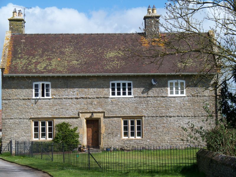
Farmhouse. Probably early C17 origin, altered in C18 and C19 - after fire damage. Rubble stone walls, tiled roof with coped gables, one stack at left end, one right of centre. 2 storeys. Door in moulded stone surround. Ground floor has 2 stone mullioned windows with casements, all under continuous string course, stepped up over door. First floor has 3. C19 casements with glazing bars under stone arches. Internally, Cross-passage has deep chamfered ceiling beams, and some plank and muntin type panelling. Rear extension part 2-storeyed, part single-storey under catslide roof. (RCHM Monument 9. (Dorset. Vol.I) R Machin "The Houses of Yetminster." University of Bristol. 1978.)
Listing NGR: ST6176208687
External links are from the relevant listing authority and, where applicable, Wikidata. Wikidata IDs may be related buildings as well as this specific building. If you want to add or update a link, you will need to do so by editing the Wikidata entry.


Other nearby listed buildings