Latitude: 50.8053 / 50°48'19"N
Longitude: -1.988 / 1°59'16"W
OS Eastings: 400942
OS Northings: 100637
OS Grid: SU009006
Mapcode National: GBR 31M.G6T
Mapcode Global: FRA 66QY.WX8
Plus Code: 9C2WR246+4R
Entry Name: Walford Bridge
Listing Date: 14 June 1952
Grade: II*
Source: Historic England
Source ID: 1119538
English Heritage Legacy ID: 107175
ID on this website: 101119538
Location: Wimborne Minster, Dorset, BH21
County: Dorset
Civil Parish: Wimborne Minster
Built-Up Area: Wimborne Minster
Traditional County: Dorset
Lieutenancy Area (Ceremonial County): Dorset
Church of England Parish: Wimborne Minster St Cuthberga
Church of England Diocese: Salisbury
Tagged with: Road bridge
WEST BOROUGH
1.
5193
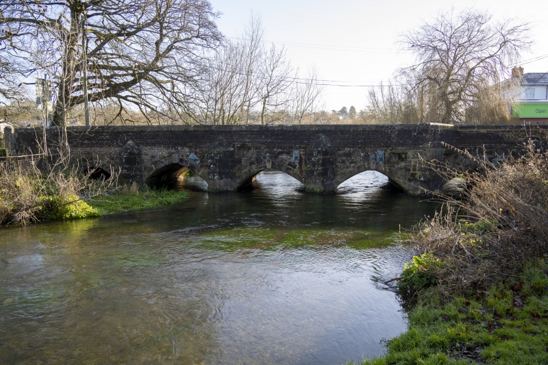
Walford Bridge
1/151 14.6.52
II*
2.
Early C16 widened on the east in the C18. West side has 7 pointed arches with
keystones and stone pointed cutwaters and a pointed pedestrian niche. Brick parapet
with stone coping. The east side is plainer and has no pedestrian niche.
Listing NGR: SU0094200637
External links are from the relevant listing authority and, where applicable, Wikidata. Wikidata IDs may be related buildings as well as this specific building. If you want to add or update a link, you will need to do so by editing the Wikidata entry.


Other nearby listed buildings