Latitude: 50.7498 / 50°44'59"N
Longitude: -2.2974 / 2°17'50"W
OS Eastings: 379112
OS Northings: 94504
OS Grid: SY791945
Mapcode National: GBR 0Z4.V9S
Mapcode Global: FRA 6723.8SZ
Plus Code: 9C2VPPX3+W2
Entry Name: West Farm Barn
Listing Date: 26 January 1956
Last Amended: 10 March 1987
Grade: II
Source: Historic England
Source ID: 1119832
English Heritage Legacy ID: 106366
ID on this website: 101119832
Location: Tolpuddle, Dorset, DT2
County: Dorset
Civil Parish: Tolpuddle
Built-Up Area: Tolpuddle
Traditional County: Dorset
Lieutenancy Area (Ceremonial County): Dorset
Church of England Parish: Tolpuddle St John the Evangelist
Church of England Diocese: Salisbury
Tagged with: Building Thatched building
TOLPUDDLE SY 7994 DORCHESTER ROAD (South Side)
15/177 West Farm Barn (formerly listed 26.1.56 under 'Pair of Barns south of Church View Cottages)
GV II
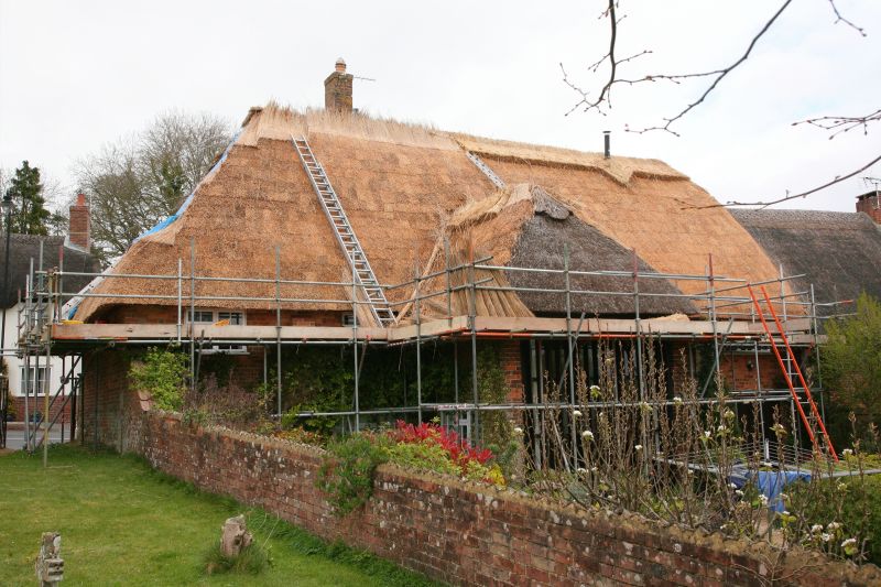
Former barn, converted to house. Mainly C18, but lower walls appear early - possibly C17 - converted C1970. Brick walls, buttressed. Hipped thatched roof. C20 central brick stack. Now 2 storeys. Elevation to road retains slit openings. Vertical boarding in east entrance, with small inserted windows. On south side, projecting hipped cart porch filled with glazing and vertical timbering. Open porch right of this. Garage doors at right end. Ground floor has three C20 casements with glazing bars. 4 similar windows on first floor. Interior remodelled. (RCHM (unnumbered) Dorset Vol III)
Listing NGR: SY7911294504
External links are from the relevant listing authority and, where applicable, Wikidata. Wikidata IDs may be related buildings as well as this specific building. If you want to add or update a link, you will need to do so by editing the Wikidata entry.


Other nearby listed buildings