Latitude: 50.7485 / 50°44'54"N
Longitude: -2.2881 / 2°17'17"W
OS Eastings: 379771
OS Northings: 94362
OS Grid: SY797943
Mapcode National: GBR 0Z4.Y2H
Mapcode Global: FRA 6733.DFG
Plus Code: 9C2VPPX6+CQ
Entry Name: Methodist Chapel, Including Boundary Railings and Memorial Gateway
Listing Date: 26 January 1956
Grade: II
Source: Historic England
Source ID: 1119836
English Heritage Legacy ID: 106370
ID on this website: 101119836
Location: Tolpuddle, Dorset, DT2
County: Dorset
Civil Parish: Tolpuddle
Built-Up Area: Tolpuddle
Traditional County: Dorset
Lieutenancy Area (Ceremonial County): Dorset
Church of England Parish: Tolpuddle St John the Evangelist
Church of England Diocese: Salisbury
Tagged with: Chapel
TOLPUDDLE SY 7994 DORCHESTER ROAD (South Side)
15/181 Methodist Chapel, including boundary railings and 26.1.56 memorial gateway
- II
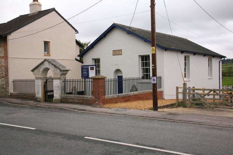
Methodist Chapel. Mid-C19, reputedly built in memory of the Tolpuddle Martyrs. Plastered walls - front wall marked out in ashlaring. Slate roof with bargeboards and bracketed eaves. At right angles to road. In gable end, flush panel door in round arched opening with solid tympanum. 2 sashes with glazing bars. 2 sashes with glazing bars in side walls. Forecourt enclosed by a low brick wall with stone coping. Iron railings with spearhead tops. Brick corner pier with moulded stone cap. Memorial gateway at front, of ashlar stone. Round arch, under pediment, inscribed "Tolpuddle Martyrs" with history and date of erection 1912. Moulded imposts. Marble panels each side commemorating the Martyrs. Iron gate with vertical rails with spearhead tops. Included for local historic interest.
Listing NGR: SY7977194362
External links are from the relevant listing authority and, where applicable, Wikidata. Wikidata IDs may be related buildings as well as this specific building. If you want to add or update a link, you will need to do so by editing the Wikidata entry.


Other nearby listed buildings