Latitude: 50.6842 / 50°41'3"N
Longitude: -2.1102 / 2°6'36"W
OS Eastings: 392309
OS Northings: 87174
OS Grid: SY923871
Mapcode National: GBR 330.19Z
Mapcode Global: FRA 67G8.HQH
Plus Code: 9C2VMVMQ+MW
Entry Name: Warehouse Beside River Frome
Listing Date: 8 April 1976
Grade: II
Source: Historic England
Source ID: 1120025
English Heritage Legacy ID: 107934
ID on this website: 101120025
Location: Wareham, Dorset, BH20
County: Dorset
Civil Parish: Wareham Town
Built-Up Area: Wareham
Traditional County: Dorset
Lieutenancy Area (Ceremonial County): Dorset
Church of England Parish: Wareham Lady St Mary
Church of England Diocese: Salisbury
Tagged with: Warehouse
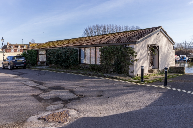
1.
5190 ABBOTS QUAY
(South Side)
Warehouse beside
River Frome
SY 9287 1/128
II
2.
Probably C19. Red brick side walls and buttresses. Otherwise random Purbeck rubble.
Corrugated iron lean-to. 1 storey. Buttresses. Modern sliding doors.
Listing NGR: SY9230987174
External links are from the relevant listing authority and, where applicable, Wikidata. Wikidata IDs may be related buildings as well as this specific building. If you want to add or update a link, you will need to do so by editing the Wikidata entry.


Other nearby listed buildings