Latitude: 50.7346 / 50°44'4"N
Longitude: -2.0621 / 2°3'43"W
OS Eastings: 395710
OS Northings: 92782
OS Grid: SY957927
Mapcode National: GBR 329.TQD
Mapcode Global: FRA 67K4.JFY
Plus Code: 9C2VPWMQ+V4
Entry Name: Lytchett Minster United Reformed Church
Listing Date: 20 November 1952
Last Amended: 30 August 1984
Grade: II
Source: Historic England
Source ID: 1120328
English Heritage Legacy ID: 108987
ID on this website: 101120328
Location: Lytchett Minster, Dorset, BH16
County: Dorset
Civil Parish: Lytchett Minster and Upton
Traditional County: Dorset
Lieutenancy Area (Ceremonial County): Dorset
Church of England Parish: Lytchett Minster
Church of England Diocese: Salisbury
Tagged with: Church building
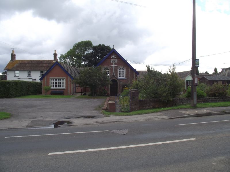
LYTCHETT MINSTER DORCHESTER ROAD SY 99 SE NORTH SIDE 4/74 Lytchett Minster United Reformed Church (Formerly listed as "Congregational Chapel") 20/11/52 - II United Reformed Church. Dated 1824 on south gable. Red brick walls with light brick dressings. Gabled slate roof with crested ridge. Simple rectangular plan, at right angles to road. Side walls buttressed. Round-arched windows with double-hung sashes with glazing bars. Entrance front has porch with coped gable and stone finial. Panelled round-arched door. Two round arched windows. C20 extensions on west, in similar style. All furnishings appear C19. RCHM Monument 2. (Dorset Vol II)
Listing NGR: SY9571092782
External links are from the relevant listing authority and, where applicable, Wikidata. Wikidata IDs may be related buildings as well as this specific building. If you want to add or update a link, you will need to do so by editing the Wikidata entry.


Other nearby listed buildings