Latitude: 50.65 / 50°39'0"N
Longitude: -2.2965 / 2°17'47"W
OS Eastings: 379132
OS Northings: 83411
OS Grid: SY791834
Mapcode National: GBR 10H.27H
Mapcode Global: FRA 672C.347
Plus Code: 9C2VMP23+29
Entry Name: Damers Farm House
Listing Date: 20 November 1959
Last Amended: 2 October 1984
Grade: II
Source: Historic England
Source ID: 1120527
English Heritage Legacy ID: 108546
ID on this website: 101120527
Location: Chaldon Herring, Dorset, DT2
County: Dorset
Civil Parish: Chaldon Herring
Traditional County: Dorset
Lieutenancy Area (Ceremonial County): Dorset
Church of England Parish: The Lulworths, Winfrith Newburgh and Chaldon
Church of England Diocese: Salisbury
Tagged with: Farmhouse Thatched farmhouse
SY 7883, SY 7983 13/88 CHALDON HERRING EAST CHALDON 20.11.59 Damers Farm House. (Formerly listed as "Damers Farm and attached barn on north side of village green")
II
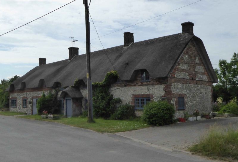
Farmhouse. Late C16-early C17. Originated as a long-house with upper-end stack. Byre rebuilt late C17-C18 - this recently demolished and replaced by new extension to house. Outbuilding at east end recently incorporated in the house. Walls of brick and stone, front wall buttressed. Thatched roof, brick stacks. One storey and attic. later single-storey lean-to at rear, of brick with slate roof. Entrance door in brick porch with thatched roof. Ground floor (excluding byre under reconstruction) has three casement windows with glazing bars. Attic has four half-dormers with similar casements. Internally, main ground floor room has large stone fireplace at east end with oak lintel, and bread oven. Chamfered ceiling beam. Remains of late C17-C18 plank and muntin partition between this room and the smaller west room. Later stack in this room adjoining byre. Roof has remains of two jointed-cruck trusses with signs of blackening - indicating possible original open hall. RCHM Monument 4.
Listing NGR: SY7913283411
External links are from the relevant listing authority and, where applicable, Wikidata. Wikidata IDs may be related buildings as well as this specific building. If you want to add or update a link, you will need to do so by editing the Wikidata entry.


Other nearby listed buildings