Latitude: 54.7709 / 54°46'15"N
Longitude: -1.5796 / 1°34'46"W
OS Eastings: 427145
OS Northings: 541856
OS Grid: NZ271418
Mapcode National: GBR KFD8.TK
Mapcode Global: WHC4Q.QB0X
Plus Code: 9C6WQCCC+95
Entry Name: Prebends Bridge
Listing Date: 6 May 1952
Grade: I
Source: Historic England
Source ID: 1121354
English Heritage Legacy ID: 110442
Also known as: Prebend's Bridge
ID on this website: 101121354
Location: Neville's Cross, County Durham, DH1
County: County Durham
Electoral Ward/Division: Elvet and Gilesgate
Parish: City of Durham
Built-Up Area: Durham
Traditional County: Durham
Lieutenancy Area (Ceremonial County): County Durham
Tagged with: Bridge
DURHAM AND FRAMWELLGATE RIVER WEAR NZ 2741 NW 16/387 Prebends' Bridge 6/5/52 GV I
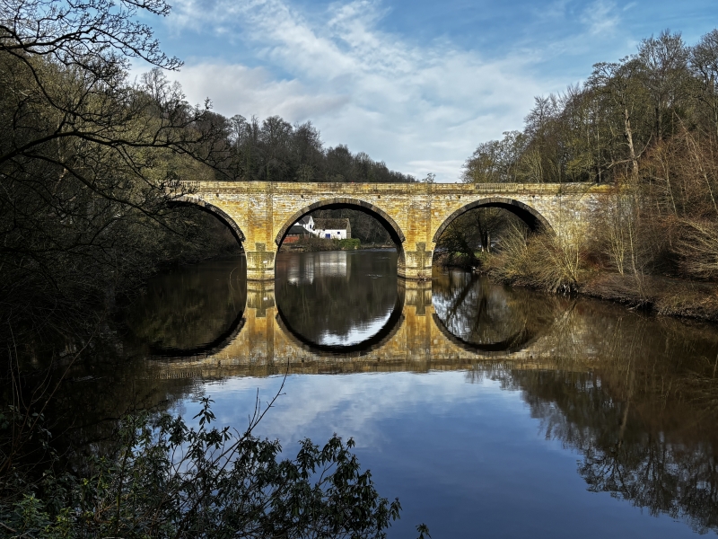
Bridge. 1772-8 by George Nicholson for the Dean and Chapter of Durham; restored 1955-6. Coursed squared sandstone and ashlar. 3 round arches with rusticated voussoirs; rusticated cutwaters; large 3-sided buttresses with tops forming refuges in parapet. Pilasters frame sections of parapet above arches, the outer ones balustraded. Abutments canted in to bridge width. Low-chamfered coping to parapets which end in ogee-domed coping on band continuous with parapet coping. Outer faces have bands at road bed level and stone drains protruding beneath them.
A scheduled ancient monument.
Listing NGR: NZ2714541856
External links are from the relevant listing authority and, where applicable, Wikidata. Wikidata IDs may be related buildings as well as this specific building. If you want to add or update a link, you will need to do so by editing the Wikidata entry.


Other nearby listed buildings