Approximate Location Map
Large Map »
Latitude: 54.7688 / 54°46'7"N
Longitude: -1.5745 / 1°34'28"W
OS Eastings: 427475
OS Northings: 541625
OS Grid: NZ274416
Mapcode National: GBR KFF9.X9
Mapcode Global: WHC4Q.SDFH
Plus Code: 9C6WQC9G+G6
Entry Name: Charley's Cross at West Corner of Junction with Church Street
Listing Date: 30 April 1971
Grade: II
Source: Historic England
Source ID: 1121392
English Heritage Legacy ID: 110432
ID on this website: 101121392
Location: County Durham, DH1
County: County Durham
Electoral Ward/Division: Elvet and Gilesgate
Parish: City of Durham
Built-Up Area: Durham
Traditional County: Durham
Lieutenancy Area (Ceremonial County): County Durham
Church of England Parish: Durham St Oswald
Church of England Diocese: Durham
Tagged with: Architectural structure Wayside cross
DURHAM AND FRAMWELLGATE QUARRYHEADS LANE
NZ 2741 NE (North side)
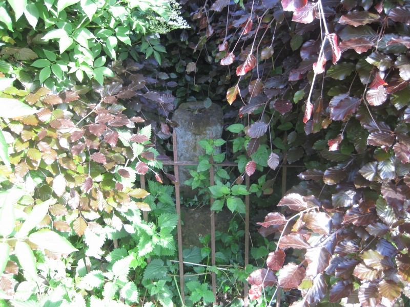
16/376 Charley's Cross at
west corner of junction
30.4.71 with Church Street
GV II
Cross base. Medieval. Sandstone. Square base about 1/2 metre high into which
part of a square shaft is inserted. Small hole in top of shaft. Said to be
one of several which marked the approaches to Durham.
Listing NGR: NZ2747541625
External links are from the relevant listing authority and, where applicable, Wikidata. Wikidata IDs may be related buildings as well as this specific building. If you want to add or update a link, you will need to do so by editing the Wikidata entry.


Other nearby listed buildings
