Latitude: 54.7769 / 54°46'36"N
Longitude: -1.5809 / 1°34'51"W
OS Eastings: 427055
OS Northings: 542520
OS Grid: NZ270425
Mapcode National: GBR KFD6.JD
Mapcode Global: WHC4Q.P6D9
Plus Code: 9C6WQCG9+PJ
Entry Name: Former Miner's Hall
Listing Date: 30 January 1976
Grade: II
Source: Historic England
Source ID: 1121435
English Heritage Legacy ID: 110333
ID on this website: 101121435
Location: Durham, County Durham, DH1
County: County Durham
Electoral Ward/Division: Elvet and Gilesgate
Parish: City of Durham
Built-Up Area: Durham
Traditional County: Durham
Lieutenancy Area (Ceremonial County): County Durham
Church of England Parish: Durham St Margaret of Antioch
Church of England Diocese: Durham
Tagged with: Building
This list entry was subject to a Minor Amendment on 26 August 2025 to amend the name and address and to reformat the text to current standards
NZ 2742 NW
9/281
DURHAM AND FRAMWELLGATE
NORTH ROAD (West side)
Nos. 15-17 (consecutive)
Former Miners' Hall
(Formerly listed as Former Miners' Hall (Ristorante La Cantina))
30.1.76
GV
II
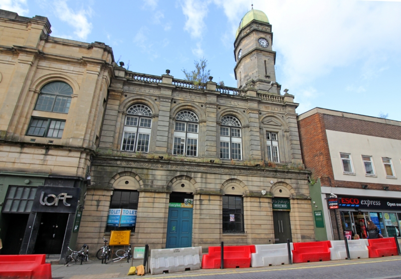
Miners' Hall. Dated 1875. Sandstone ashlar; roof not visible. Two storeys, four bays; tower over fourth. Ground floor C20 shops. First floor has bays defined by pilasters; round-headed windows in recessed arches, the right end window smaller and pedimented in architrave with pediment. Rusticated pilasters have paterae on necking. Top entablature inscribed. Balustraded parapet has globe and square finials. Two-stage octagonal tower has round-headed slits; angle pilasters; high octagonal dome has two ball-and-spike finials.
Listing NGR: NZ2705542520
External links are from the relevant listing authority and, where applicable, Wikidata. Wikidata IDs may be related buildings as well as this specific building. If you want to add or update a link, you will need to do so by editing the Wikidata entry.


Other nearby listed buildings