Latitude: 52.2023 / 52°12'8"N
Longitude: 0.1185 / 0°7'6"E
OS Eastings: 544873
OS Northings: 258122
OS Grid: TL448581
Mapcode National: GBR L79.SY2
Mapcode Global: VHHK3.0XH3
Plus Code: 9F426429+WC
Entry Name: 5, 6, 7 and 7A, Botolph Lane
Listing Date: 2 November 1972
Grade: II
Source: Historic England
Source ID: 1122633
English Heritage Legacy ID: 47347
ID on this website: 101122633
Location: Cambridge, Cambridgeshire, CB2
County: Cambridgeshire
District: Cambridge
Electoral Ward/Division: Market
Parish: Non Civil Parish
Built-Up Area: Cambridge
Traditional County: Cambridgeshire
Lieutenancy Area (Ceremonial County): Cambridgeshire
Church of England Parish: Cambridge St Botolph
Church of England Diocese: Ely
Tagged with: Building
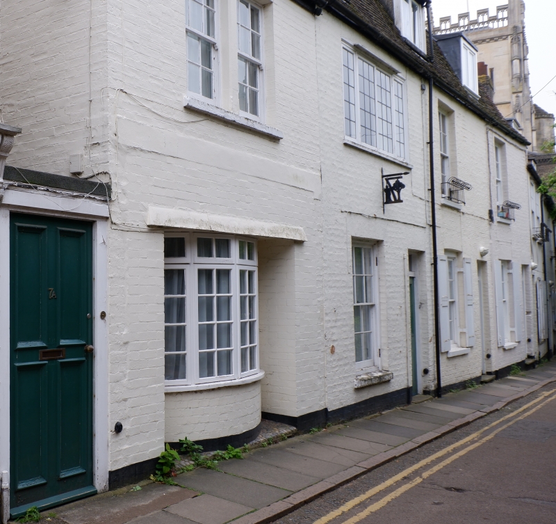
BOTOLPH LANE
1.
942
(South Side)
Nos 5 & 6
Nos 7 & 7A
TL 4458 SE 6/31
II GV
2.
Late C18/Early Cl9. 3 tenements, one building. Brick with tiled roof.
2 storeys and attic. 3 windows with glazing bars; shutters on ground floor;
one window on ground floor and one window on first floor altered; three
flat-topped dormers, in mansard roof. Modern bow window to No 7A.
All the listed buildings in Botolph Lane form a group.
Listing NGR: TL4487358122
External links are from the relevant listing authority and, where applicable, Wikidata. Wikidata IDs may be related buildings as well as this specific building. If you want to add or update a link, you will need to do so by editing the Wikidata entry.


Other nearby listed buildings