Approximate Location Map
Large Map »
Latitude: 51.8896 / 51°53'22"N
Longitude: 0.8939 / 0°53'37"E
OS Eastings: 599236
OS Northings: 225186
OS Grid: TL992251
Mapcode National: GBR SN4.JSQ
Mapcode Global: VHKFZ.FRXS
Plus Code: 9F32VVQV+RH
Entry Name: The Balkerne Gate
Listing Date: 24 February 1950
Grade: I
Source: Historic England
Source ID: 1123668
English Heritage Legacy ID: 116857
ID on this website: 101123668
Location: Colchester, Essex, CO3
County: Essex
District: Colchester
Electoral Ward/Division: Castle
Parish: Non Civil Parish
Built-Up Area: Colchester
Traditional County: Essex
Lieutenancy Area (Ceremonial County): Essex
Church of England Parish: Colchester St Peter
Church of England Diocese: Chelmsford
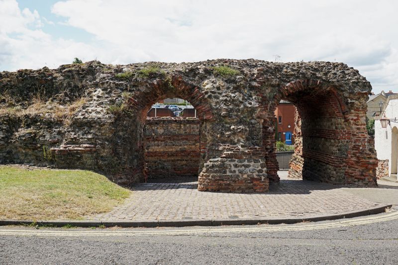
1. BALKERNE LANE
995 (East Side)
-----------
The Balkerne Gate
TL 9925 SW 4/2 24.2.50.
I
2.
Probably of C2 date, rather earlier than the walls themselves.
The ruin of the only remaining Roman gateway in the town wall. It is a
remarkable monument and the best preserved of any Roman gateway in the
country. It is also the largest, - 107 ft wide with 2 carriageways and 2
footways. It has been over-built by the Hole-in-the-wall Public House,
But the north tower still stands 20 ft high and the arches of the
south footway are 13 ft. A.M.
Listing NGR: TL9923625186
External links are from the relevant listing authority and, where applicable, Wikidata. Wikidata IDs may be related buildings as well as this specific building. If you want to add or update a link, you will need to do so by editing the Wikidata entry.


Other nearby listed buildings
