Approximate Location Map
Large Map »
Latitude: 51.8221 / 51°49'19"N
Longitude: -1.0554 / 1°3'19"W
OS Eastings: 465198
OS Northings: 214146
OS Grid: SP651141
Mapcode National: GBR 9ZR.PZD
Mapcode Global: VHCXK.NGDH
Plus Code: 9C3WRWCV+VR
Entry Name: Windmill
Listing Date: 25 October 1951
Grade: II*
Source: Historic England
Source ID: 1124265
English Heritage Legacy ID: 42447
ID on this website: 101124265
Location: Brill, Buckinghamshire, HP18
County: Buckinghamshire
Civil Parish: Brill
Built-Up Area: Brill
Traditional County: Buckinghamshire
Lieutenancy Area (Ceremonial County): Buckinghamshire
Church of England Parish: Brill
Church of England Diocese: Oxford
Tagged with: Windmill
SP 61 SE BRILL WINDMILL STREET
6/66 Windmill
25.10.51
- II*
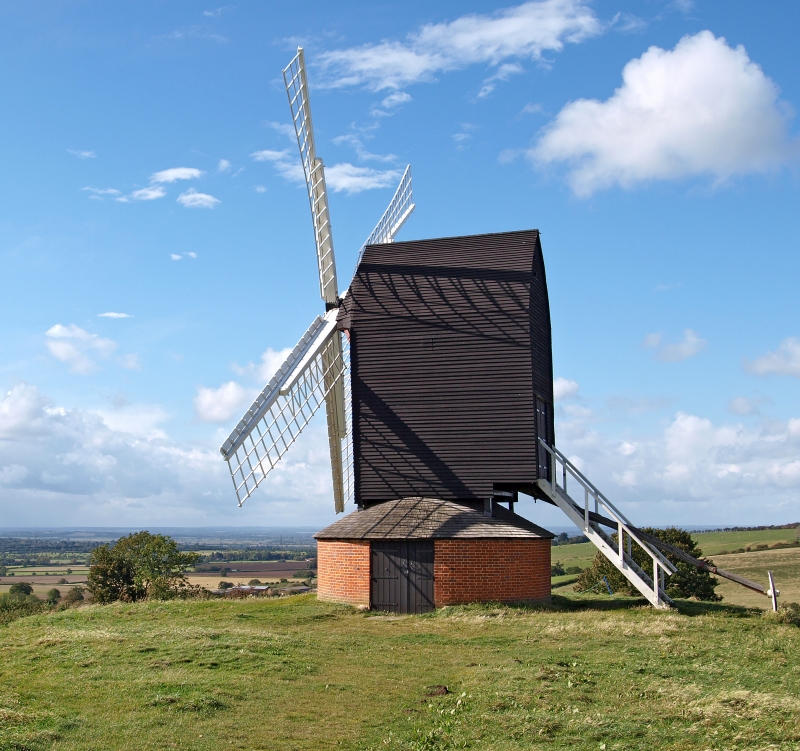
Post mill. Late C17, dated RCE?68? IC on beam. Much repaired C20. Mill
has timber frame with weatherboard cladding carried up over curved roof
pitches. Circular base of C19 brick with conical slate roof, 2 wooden
louvres and a board door. 4 sails, tail pole. Important landmark.
RCHM I p. 66 Mon. 22.
Listing NGR: SP6519814146
External links are from the relevant listing authority and, where applicable, Wikidata. Wikidata IDs may be related buildings as well as this specific building. If you want to add or update a link, you will need to do so by editing the Wikidata entry.


Other nearby listed buildings
