Approximate Location Map
Large Map »
Latitude: 51.5718 / 51°34'18"N
Longitude: -0.5484 / 0°32'54"W
OS Eastings: 500697
OS Northings: 186876
OS Grid: TQ006868
Mapcode National: GBR G8V.D5L
Mapcode Global: VHFSX.FRYG
Plus Code: 9C3XHFC2+PJ
Entry Name: Piers and Gates to St Hubert's House
Listing Date: 24 April 1985
Grade: II
Source: Historic England
Source ID: 1124391
English Heritage Legacy ID: 44106
ID on this website: 101124391
Location: Buckinghamshire, SL9
County: Buckinghamshire
Civil Parish: Gerrards Cross
Built-Up Area: Gerrards Cross
Traditional County: Buckinghamshire
Lieutenancy Area (Ceremonial County): Buckinghamshire
Church of England Parish: Gerrard's Cross and Fulmer
Church of England Diocese: Oxford
TQ 08 NW GERRARDS CROSS ST HUBERT'S LANE
5/504 Piers and gates to
St Hubert's House
-
- II
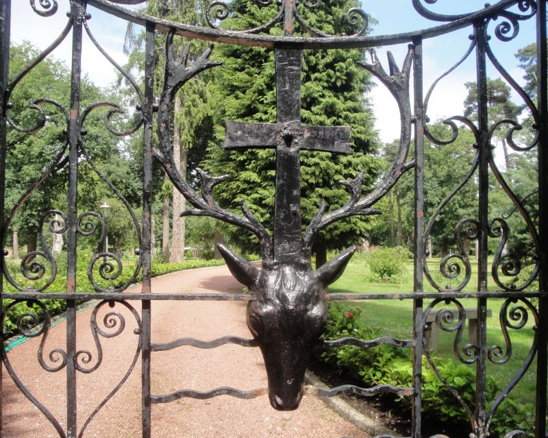
Circa 1860 and in materials and style similar to the house. Three smaller piers
with curved flank walls. Railings with lotus tops; wrought iron gates with
emblem of St Hubert.
Listing NGR: TQ0069786876
External links are from the relevant listing authority and, where applicable, Wikidata. Wikidata IDs may be related buildings as well as this specific building. If you want to add or update a link, you will need to do so by editing the Wikidata entry.


Other nearby listed buildings
