Approximate Location Map
Large Map »
Latitude: 51.5776 / 51°34'39"N
Longitude: -0.5708 / 0°34'14"W
OS Eastings: 499133
OS Northings: 187488
OS Grid: SU991874
Mapcode National: GBR F7H.0HL
Mapcode Global: VHFSX.2M30
Plus Code: 9C3XHCHH+2M
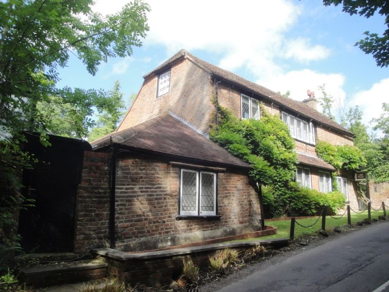
Entry Name: Mill House
Listing Date: 24 April 1985
Grade: II
Source: Historic England
Source ID: 1124428
English Heritage Legacy ID: 44100
ID on this website: 101124428
Location: Buckinghamshire, SL9
County: Buckinghamshire
Civil Parish: Gerrards Cross
Built-Up Area: Gerrards Cross
Traditional County: Buckinghamshire
Lieutenancy Area (Ceremonial County): Buckinghamshire
Church of England Parish: Gerrard's Cross and Fulmer
Church of England Diocese: Oxford
Tagged with: House
SU 98 NE GERRARDS CROSS HEDGERLEY LANE
4/495 Mill House
-
- II
C17/C18; part timber-framed, part old red-blue brick in header bond; old
tile-hiped roof. Two storeys. All windows modern casements with diamond leaded
lights.
Listing NGR: SU9913387488
External links are from the relevant listing authority and, where applicable, Wikidata. Wikidata IDs may be related buildings as well as this specific building. If you want to add or update a link, you will need to do so by editing the Wikidata entry.


Other nearby listed buildings
