Approximate Location Map
Large Map »
Latitude: 51.7042 / 51°42'15"N
Longitude: -0.6159 / 0°36'57"W
OS Eastings: 495741
OS Northings: 201518
OS Grid: SP957015
Mapcode National: GBR F5W.13W
Mapcode Global: VHFS9.8FRC
Plus Code: 9C3XP93M+MJ
Entry Name: The Vicarage
Listing Date: 10 November 1951
Grade: II
Source: Historic England
Source ID: 1124654
English Heritage Legacy ID: 43528
ID on this website: 101124654
Location: Chesham, Buckinghamshire, HP5
County: Buckinghamshire
Civil Parish: Chesham
Built-Up Area: Chesham
Traditional County: Buckinghamshire
Lieutenancy Area (Ceremonial County): Buckinghamshire
Church of England Parish: Great Chesham
Church of England Diocese: Oxford
Tagged with: Clergy house
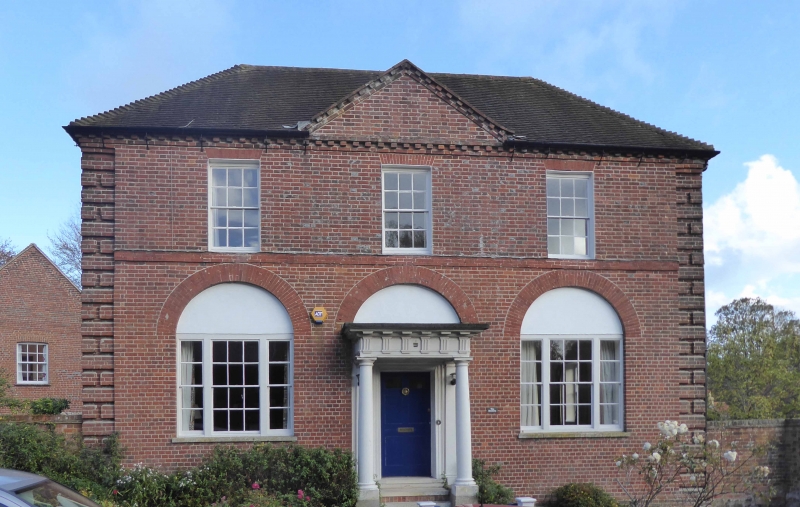
CHURCH STREET
1.
967
(North Side)
The Vicarage
SP 9501 NE 2/3 10.11.51.
II GV
2.
1767 at the expense of the patron,John, 4th Duke of Bedford, Cl8 house of red
brick. Hipped tiled roof with corbelled cornice and central pediment. 2 storeys,
rusticated flush angle pilasters. 3 sash windows with glazing bars in reveals,
1st floor flat arches, ground floor semi-circular arched panels. Band at 1st
floor level. Central Doric porch with triglyph frieze and modillion cornice to
entablature.
The Vicarage, Vicarage Annexe, and the gates & gate piers to the Vicarage and to
Lowndes Park form a group.
Listing NGR: SP9574301519
External links are from the relevant listing authority and, where applicable, Wikidata. Wikidata IDs may be related buildings as well as this specific building. If you want to add or update a link, you will need to do so by editing the Wikidata entry.


Other nearby listed buildings
