Approximate Location Map
Large Map »
Latitude: 51.6811 / 51°40'51"N
Longitude: -0.6685 / 0°40'6"W
OS Eastings: 492150
OS Northings: 198875
OS Grid: SU921988
Mapcode National: GBR F5Z.KT2
Mapcode Global: VHFSG.C0FL
Plus Code: 9C3XM8JJ+CH
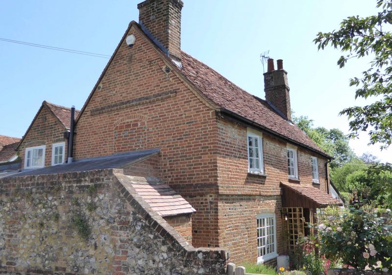
Entry Name: Dering Cottage
Listing Date: 17 March 1982
Grade: II
Source: Historic England
Source ID: 1124955
English Heritage Legacy ID: 44465
ID on this website: 101124955
Location: Little Missenden, Buckinghamshire, HP7
County: Buckinghamshire
Civil Parish: Little Missenden
Traditional County: Buckinghamshire
Lieutenancy Area (Ceremonial County): Buckinghamshire
Church of England Parish: Little Missenden
Church of England Diocese: Oxford
Tagged with: Cottage
LITTLE MISSENDEN LITTLE MISSENDEN VILLAGE
1.
5134
(south side)
SU 9298 4/21 Dering Cottage
II
GV
2.
C18 3 bay 2 storey house with gable to road. Red brick, old tile roof. Parallel
roofed 2 storey lower rear range. Paired casements 2 doors in centre bay.
End stacks. Band course to gable.
Listing NGR: SU9215298875
External links are from the relevant listing authority and, where applicable, Wikidata. Wikidata IDs may be related buildings as well as this specific building. If you want to add or update a link, you will need to do so by editing the Wikidata entry.


Other nearby listed buildings
