Approximate Location Map
Large Map »
Latitude: 51.6186 / 51°37'7"N
Longitude: -0.7175 / 0°43'2"W
OS Eastings: 488888
OS Northings: 191868
OS Grid: SU888918
Mapcode National: GBR D5C.KDJ
Mapcode Global: VHDW5.JL10
Plus Code: 9C3XJ79M+F2
Entry Name: 2 and 4, Abbey Barn Road
Listing Date: 28 June 1973
Grade: II
Source: Historic England
Source ID: 1125204
English Heritage Legacy ID: 45953
ID on this website: 101125204
Location: Wycombe Marsh, Buckinghamshire, HP11
County: Buckinghamshire
Electoral Ward/Division: Ryemead
Parish: Non Civil Parish
Built-Up Area: High Wycombe
Traditional County: Buckinghamshire
Lieutenancy Area (Ceremonial County): Buckinghamshire
Church of England Parish: High Wycombe Saint Anne and Saint Peter
Church of England Diocese: Oxford
Tagged with: Building
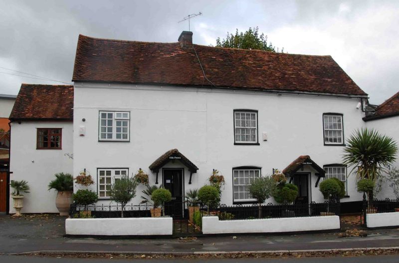
ABBEY BARN ROAD
1.
963
(North Side)
Nos 2 & 4
SU 8891 NE 4/210
II
2.
C18, altered. Stucco, old tile roof with weatherboarded long box dormer
containing 2 casements with glazing bars. 2 storeys and attic. No 2 has
2 sashes with glazing bars, No 4 modern large gromd floor window and half
glazed door in wide wooden surround; 1st floor 3 light casement with glazing
bars.
Listing NGR: SU8888891868
External links are from the relevant listing authority and, where applicable, Wikidata. Wikidata IDs may be related buildings as well as this specific building. If you want to add or update a link, you will need to do so by editing the Wikidata entry.


Other nearby listed buildings
